Hayfield, Minnesota
Hayfield is a city in Dodge County, Minnesota, United States. The population was 1,340 at the 2010 census.[6]
Hayfield | |
|---|---|
| Motto(s): "Where people make progress" | |
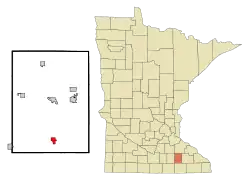 Location of Hayfield, Minnesota | |
| Coordinates: 43°53′21″N 92°50′46″W | |
| Country | United States |
| State | Minnesota |
| County | Dodge |
| Government | |
| • Type | City |
| • Mayor | Rich Fjersted |
| • City Clerk | Lori Kindschy |
| Area | |
| • Total | 1.26 sq mi (3.26 km2) |
| • Land | 1.26 sq mi (3.26 km2) |
| • Water | 0.00 sq mi (0.00 km2) |
| Elevation | 1,319 ft (402 m) |
| Population | |
| • Total | 1,340 |
| • Estimate (2019)[3] | 1,337 |
| • Density | 1,061.11/sq mi (409.81/km2) |
| Time zone | UTC-6 (Central (CST)) |
| • Summer (DST) | UTC-5 (CDT) |
| ZIP code | 55940 |
| Area code(s) | 507 |
| FIPS code | 27-27872[4] |
| GNIS feature ID | 0644794[5] |
| Website | www.hayfieldmn.com |
History
The Hayfield branch of the U.S. Post Office has been in operation since 1885.[7] Hayfield was incorporated in 1896.[8] Hayfield Township was organized March 30, 1872, having previously been a part of Vernon. Its name was adopted from a township of Crawford County in northwestern Pennsylvania. The city of Hayfield, sections 15 and 22, was incorporated January 7, 1896; it had a station of the Chicago Great Western Railroad; the Vernon Co-operative Creamery near Hayfield was the oldest farmer-owned creamery in the state.[9]
Geography
According to the United States Census Bureau, the city has a total area of 1.27 square miles (3.29 km2), all of it land.[10]
Transportation
Minnesota State Highways 30 and 56 are the two highways running through the community.
Demographics
| Historical population | |||
|---|---|---|---|
| Census | Pop. | %± | |
| 1900 | 439 | — | |
| 1910 | 586 | 33.5% | |
| 1920 | 799 | 36.3% | |
| 1930 | 730 | −8.6% | |
| 1940 | 742 | 1.6% | |
| 1950 | 805 | 8.5% | |
| 1960 | 889 | 10.4% | |
| 1970 | 939 | 5.6% | |
| 1980 | 1,243 | 32.4% | |
| 1990 | 1,283 | 3.2% | |
| 2000 | 1,325 | 3.3% | |
| 2010 | 1,340 | 1.1% | |
| 2019 (est.) | 1,337 | [3] | −0.2% |
| U.S. Decennial Census[11] | |||
2010 census
As of the census[2] of 2010, there were 1,340 people, 547 households, and 348 families living in the city. The population density was 1,055.1 inhabitants per square mile (407.4/km2). There were 597 housing units at an average density of 470.1 per square mile (181.5/km2). The racial makeup of the city was 95.4% White, 0.4% African American, 0.5% Native American, 0.1% Asian, 0.1% Pacific Islander, 1.6% from other races, and 1.9% from two or more races. Hispanic or Latino people of any race were 5.5% of the population.
There were 547 households, of which 34.6% had children under the age of 18 living with them, 45.9% were married couples living together, 11.2% had a female householder with no husband present, 6.6% had a male householder with no wife present, and 36.4% were non-families. 32.7% of all households were made up of individuals, and 15.2% had someone living alone who was 65 years of age or older. The average household size was 2.37 and the average family size was 2.95.
The median age in the city was 36 years. 27.2% of residents were under the age of 18; 7.6% were between the ages of 18 and 24; 24% were from 25 to 44; 23.3% were from 45 to 64; and 17.9% were 65 years of age or older. The gender makeup of the city was 48.7% male and 51.3% female.
2000 census
As of the census[4] of 2000, there were 1,325 people, 496 households, and 329 families living in the city. The population density was 1,049.6 people per square mile (406.0/km2). There were 519 housing units at an average density of 411.1 per square mile (159.0/km2). The racial makeup of the city was 97.28% White, 0.23% African American, 0.60% Native American, 0.68% Asian, 0.53% from other races, and 0.68% from two or more races. Hispanic or Latino people of any race were 2.26% of the population.
There were 496 households, out of which 35.7% had children under the age of 18 living with them, 55.0% were married couples living together, 8.3% had a female householder with no husband present, and 33.5% were non-families. 29.4% of all households were made up of individuals, and 17.5% had someone living alone who was 65 years of age or older. The average household size was 2.50 and the average family size was 3.15.
In the city, the population was spread out, with 27.3% under the age of 18, 9.4% from 18 to 24, 24.8% from 25 to 44, 18.0% from 45 to 64, and 20.5% who were 65 years of age or older. The median age was 37 years. For every 100 females, there were 91.8 males. For every 100 females age 18 and over, there were 84.1 males.
The median income for a household in the city was $38,214, and the median income for a family was $47,981. Males had a median income of $29,293 versus $24,135 for females. The per capita income for the city was $17,201. About 1.2% of families and 4.4% of the population were below the poverty line, including 2.2% of those under age 18 and 11.7% of those age 65 or over.
Schools
Hayfield has two schools, an elementary school and a secondary school. Their school colors are blue and gold, and their mascot is the Vikings. They compete in the Gopher Conference. They have the following sports in their district: baseball, basketball (boys and girls), cross country, dance, football, hockey, softball, track & field, golf (boys and girls), volleyball and wrestling.
Parks and recreation
Parks
The city of Hayfield has two parks in town for the public to use. The Earl B. Himle Park and the Rouhoff Memorial Park. Earl Himle Park is located next the city of Hayfields public pool and softball fields.
Religion
- Cedar Creek Church
- Evanger Lutheran Church, ELCA
- First Presbyterian Church
- Sacred Heart Catholic Church
- Trinity Lutheran Church
- West St. Olaf Lutheran Church, ELCA
Notable residents
- Russell L. Blaisdell, United States military chaplain and Presbyterian minister; born in Hayfield
- George R. Wicker, Minnesota legislator, businessman, and newspaper editor; worked in Hayfield
- Dave Senjem, Minnesota politician and member of the Minnesota Senate. He served as its majority leader from 2011 to 2013.A Republican, Senjem represents District 25, which includes portions of Dodge and Olmsted counties in the southeastern part of the state.
- Randy Demmer, Minnesota politician and a former member of the Minnesota House of Representatives who represented District 29A, which includes portions of Dodge and Olmsted counties in the southeastern part of the state. A Republican, he is also a local business owner, manager, and consultant.
References
- "2019 U.S. Gazetteer Files". United States Census Bureau. Retrieved July 26, 2020.
- "U.S. Census website". United States Census Bureau. Retrieved 2012-11-13.
- "Population and Housing Unit Estimates". United States Census Bureau. May 24, 2020. Retrieved May 27, 2020.
- "U.S. Census website". United States Census Bureau. Retrieved 2008-01-31.
- "US Board on Geographic Names". United States Geological Survey. 2007-10-25. Retrieved 2008-01-31.
- "2010 Census Redistricting Data (Public Law 94-171) Summary File". American FactFinder. United States Census Bureau. Retrieved 27 April 2011.
- "Dodge County". Jim Forte Postal History. Retrieved 14 May 2015.
- Upham, Warren (1920). Minnesota Geographic Names: Their Origin and Historic Significance. Minnesota Historical Society. p. 173.
- "Homepage - MNHS.ORG". Minnesota Historical Society. Retrieved 2019-02-21.
- "US Gazetteer files 2010". United States Census Bureau. Retrieved 2012-11-13.
- "Census of Population and Housing". Census.gov. Retrieved June 4, 2015.
Municipalities and communities of Dodge County, Minnesota, United States | ||
|---|---|---|
| Cities | 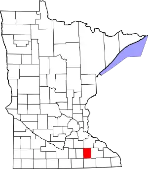 Map of Minnesota highlighting Dodge County | |
| Townships | ||
| Unincorporated communities | ||
| Ghost town | ||
| Footnotes | ‡This populated place also has portions in an adjacent county or counties | |
| ||
| Authority control |
|---|