Henry's Moat
Henry’s Moat is a hamlet and parish in Pembrokeshire, Wales, in the community of Puncheston. It is 7 miles (11 km) southeast of Fishguard and 9 miles (14 km) northeast of Haverfordwest. The nearest railway station is Clarbeston Road 5 miles (8 km) to the south. It was in the ancient Hundred of Cemais.
Henry’s Moat
| |
|---|---|
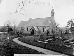 St Brynach's Church, about 1885 | |
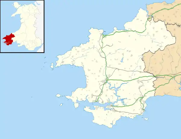 Henry’s Moat Location within Pembrokeshire | |
| OS grid reference | SN044276 |
| Community |
|
| Principal area | |
| Country | Wales |
| Sovereign state | United Kingdom |
| Postcode district | SA63 |
| Police | Dyfed-Powys |
| Fire | Mid and West Wales |
| Ambulance | Welsh |
| UK Parliament |
|
Name
The parish’s Welsh name was Castell Hên-drêv (or Hendre), Anglicised by early English settlers to its present form. It derives from an ancient tumulus surrounded by a moat.[1] It appears as Castel henrye on a 1578 parish map of Pembrokeshire.[2]
History
In 1833 the population of the parish was 282.[1] It includes the hamlet of Tufton on the nearby B4329 Cardigan to Haverfordwest turnpike.[3]
References
- "GENUKI: Henry's Moat". Retrieved 25 April 2015.
- "Penbrok comitat". British Library.
- "GENUKI: Parish maps". Retrieved 25 April 2015.
External links
| Wikimedia Commons has media related to Henry's Moat. |
This article is issued from Wikipedia. The text is licensed under Creative Commons - Attribution - Sharealike. Additional terms may apply for the media files.
