Highland, Kansas
Highland is a city in Doniphan County, Kansas, United States. As of the 2010 census, the city population was 1,012.[6] It is home to Highland Community College.
Highland, Kansas | |
|---|---|
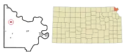
 Location within Doniphan County and Kansas | |
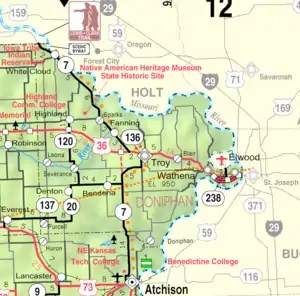
 KDOT map of Doniphan County (legend) | |
| Coordinates: 39°51′36″N 95°16′1″W | |
| Country | United States |
| State | Kansas |
| County | Doniphan |
| Founded | 1854 |
| Platted | 1857 |
| Named for | Highland, Illinois |
| Area | |
| • Total | 0.53 sq mi (1.36 km2) |
| • Land | 0.53 sq mi (1.36 km2) |
| • Water | 0.00 sq mi (0.00 km2) |
| Elevation | 1,050 ft (320 m) |
| Population | |
| • Total | 1,012 |
| • Estimate (2019)[3] | 995 |
| • Density | 1,895.24/sq mi (731.07/km2) |
| Time zone | UTC-6 (Central (CST)) |
| • Summer (DST) | UTC-5 (CDT) |
| ZIP code | 66035 |
| Area code(s) | 785 |
| FIPS code | 20-31850 [4] |
| GNIS ID | 0473010 [5] |
| Website | highlandks.com |
History
The first settlement at Highland was made in 1837 by missionaries.[7] Highland was laid out in 1857.[8] It was named after the city of Highland, Illinois.[9]
The founders of Highland planned from the start for their city to be a place of higher learning, and soon after the town was laid out, Highland University was established.[10]
Geography
Highland is located at 39°51′36″N 95°16′1″W (39.860042, -95.266816).[11] According to the United States Census Bureau, the city has a total area of 0.53 square miles (1.37 km2), all land.[12]
Demographics
It is part of the St. Joseph, Missouri–Kansas Metropolitan Statistical Area.
| Historical population | |||
|---|---|---|---|
| Census | Pop. | %± | |
| 1860 | 120 | — | |
| 1870 | 282 | 135.0% | |
| 1880 | 441 | 56.4% | |
| 1890 | 493 | 11.8% | |
| 1900 | 780 | 58.2% | |
| 1910 | 763 | −2.2% | |
| 1920 | 809 | 6.0% | |
| 1930 | 788 | −2.6% | |
| 1940 | 764 | −3.0% | |
| 1950 | 717 | −6.2% | |
| 1960 | 755 | 5.3% | |
| 1970 | 899 | 19.1% | |
| 1980 | 954 | 6.1% | |
| 1990 | 942 | −1.3% | |
| 2000 | 976 | 3.6% | |
| 2010 | 1,012 | 3.7% | |
| 2019 (est.) | 995 | [3] | −1.7% |
| U.S. Decennial Census | |||
2010 census
At the 2010 census,[2] there were 1,012 people, 296 households and 155 families living in the city. The population density was 1,909.4 inhabitants per square mile (737.2/km2). There were 372 housing units at an average density of 701.9 per square mile (271.0/km2). The racial makeup of the city was 84.7% White, 10.0% African American, 1.1% Native American, 0.4% Asian, 0.8% from other races, and 3.1% from two or more races. Hispanic or Latino of any race were 2.0% of the population.
There were 296 households, of which 23.6% had children under the age of 18 living with them, 41.6% were married couples living together, 7.8% had a female householder with no husband present, 3.0% had a male householder with no wife present, and 47.6% were non-families. 39.9% of all households were made up of individuals, and 16.2% had someone living alone who was 65 years of age or older. The average household size was 2.16 and the average family size was 2.94.
The median age in the city was 21.8 years. 12.7% of residents were under the age of 18; 41.8% were between the ages of 18 and 24; 14.6% were from 25 to 44; 17.2% were from 45 to 64; and 13.8% were 65 years of age or older. The sex makeup of the city was 53.3% male and 46.7% female.
2000 census
At the 2000 census,[4] there were 976 people, 316 households and 169 families living in the city. The population density was 1,842.6 per square mile (711.0/km2). There were 344 housing units at an average density of 649.5 per square mile (250.6/km2). The racial makeup of the city was 90.27% White, 5.74% African American, 1.02% Native American, 0.20% Asian, 0.92% from other races, and 1.84% from two or more races. Hispanic or Latino of any race were 1.33% of the population.
There were 316 households, of which 20.3% had children under the age of 18 living with them, 44.6% were married couples living together, 7.3% had a female householder with no husband present, and 46.5% were non-families. 41.8% of all households were made up of individuals, and 22.2% had someone living alone who was 65 years of age or older. The average household size was 2.02 and the average family size was 2.76.
12.3% of the population were under the age of 18, 36.5% from 18 to 24, 14.2% from 25 to 44, 15.2% from 45 to 64, and 21.8% who were 65 years of age or older. The median age was 28 years. For every 100 females, there were 95.6 males. For every 100 females age 18 and over, there were 100.5 males.
The median household income was $25,250 and the median family income was $37,969. Males had a median income of $30,298 compared with $22,250 for females. The per capita income for the city was $12,341. About 9.0% of families and 17.4% of the population were below the poverty line, including 10.6% of those under age 18 and 13.9% of those age 65 or over.
Education
Primary and Secondary Education
The community is served by Doniphan West USD 111 public school district, and home to Doniphan West Jr/Sr High School since 2009. The Doniphan West Jr/Sr High School mascot is Doniphan West Mustangs.[13]
Highland High School was closed through school unification. The Highland Blue Streaks[14] won the Kansas State High School boys class 1A Track & Field championship in 1969 and 1990.[15]
Colleges and Universities
Highland Community College is a Kansas Jayhawk Community College Conference (KJCCC) member school.
Notable people
- John Misse, baseball player
See also
References
- "2019 U.S. Gazetteer Files". United States Census Bureau. Retrieved July 24, 2020.
- "U.S. Census website". United States Census Bureau. Retrieved July 6, 2012.
- "Population and Housing Unit Estimates". United States Census Bureau. May 24, 2020. Retrieved May 27, 2020.
- "U.S. Census website". United States Census Bureau. Retrieved 2008-01-31.
- "US Board on Geographic Names". United States Geological Survey. 2007-10-25. Retrieved 2008-01-31.
- "2010 City Population and Housing Occupancy Status". U.S. Census Bureau. Retrieved August 11, 2011.
- Blackmar, Frank Wilson (1912). Kansas: A Cyclopedia of State History, Embracing Events, Institutions, Industries, Counties, Cities, Towns, Prominent Persons, Etc. Standard Publishing Company. pp. 843.
- Kansas State Historical Society (1916). Biennial Report of the Board of Directors of the Kansas State Historical Society. Kansas State Printing Plant. pp. 178.
- "Profile for Highland, Kansas". ePodunk. Archived from the original on 14 July 2014. Retrieved 8 June 2014.
- Gray, Patrick Leopoldo (1905). Gray's Doniphan County History: A Record of the Happenings of Half a Hundred Years. Roycroft Press. pp. 38.
- "US Gazetteer files: 2010, 2000, and 1990". United States Census Bureau. 2011-02-12. Retrieved 2011-04-23.
- "US Gazetteer files 2010". United States Census Bureau. Archived from the original on 2012-01-25. Retrieved 2012-07-06.
- "Doniphan West USD 111". USD 111. Retrieved 1 January 2017.
- "Highland 35 Reserve 6", The Atchison Daily Globe, 8 October 1961, p.4.
- "Track & Field". KSHSAA. Retrieved 6 January 2017.
Further reading
External links
- City of Highland
- Highland - Directory of Public Officials
- Native American Heritage Museum SHS, KansasPhotoTour.com
- Highland City Map, KDOT
