Holiday City South, New Jersey
Holiday City South is an unincorporated community and census-designated place (CDP) located within Berkeley Township, in Ocean County, New Jersey, United States.[6][7][8] As of the 2010 United States Census, the CDP's population was 3,689.[3]
Holiday City South, New Jersey | |
|---|---|
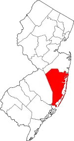
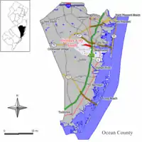 Map of Holiday City South CDP in Ocean County. Inset: Location of Ocean County in New Jersey. | |
| Coordinates: 39.954094°N 74.237294°W | |
| Country | |
| State | |
| County | Ocean |
| Township | Berkeley |
| Area | |
| • Total | 1.983 sq mi (5.136 km2) |
| • Land | 1.961 sq mi (5.079 km2) |
| • Water | 0.022 sq mi (0.057 km2) 1.10% |
| Elevation | 33 ft (10 m) |
| Population | |
| • Total | 3,689 |
| • Density | 1,881.1/sq mi (726.3/km2) |
| Time zone | UTC-5 (Eastern (EST)) |
| • Summer (DST) | UTC-4 (Eastern (EDT)) |
| Area code(s) | 609 |
| FIPS code | 3432418[1][4] |
| GNIS feature ID | 02389941[1][5] |
Geography
According to the United States Census Bureau, the CDP had a total area of 1.983 square miles (5.136 km2), including 1.961 square miles (5.079 km2) of land and 0.022 square miles (0.057 km2) of water (1.10%).[1][9]
Demographics
| Historical population | |||
|---|---|---|---|
| Census | Pop. | %± | |
| 1990 | 5,452 | — | |
| 2000 | 4,047 | −25.8% | |
| 2010 | 3,689 | −8.8% | |
| Sources: 1990-2010[8] 2000[10] 2010[3] | |||
Census 2010
The 2010 United States Census counted 3,689 people, 2,257 households, and 1,104 families in the CDP. The population density was 1,881.1 per square mile (726.3/km2). There were 2,460 housing units at an average density of 1,254.4 per square mile (484.3/km2). The racial makeup was 92.19% (3,401) White, 5.58% (206) Black or African American, 0.11% (4) Native American, 0.70% (26) Asian, 0.08% (3) Pacific Islander, 0.43% (16) from other races, and 0.89% (33) from two or more races. Hispanic or Latino of any race were 2.60% (96) of the population.[3]
Of the 2,257 households, 1.6% had children under the age of 18; 38.7% were married couples living together; 8.2% had a female householder with no husband present and 51.1% were non-families. Of all households, 48.6% were made up of individuals and 43.0% had someone living alone who was 65 years of age or older. The average household size was 1.63 and the average family size was 2.22.[3]
2.7% of the population were under the age of 18, 1.7% from 18 to 24, 4.9% from 25 to 44, 17.3% from 45 to 64, and 73.4% who were 65 years of age or older. The median age was 75.6 years. For every 100 females, the population had 70.2 males. For every 100 females ages 18 and older there were 68.9 males.[3]
Census 2000
As of the 2000 United States Census[4] there were 4,047 people, 2,385 households, and 1,411 families living in the CDP. The population density was 831.1/km2 (2,157.7/mi2). There were 2,470 housing units at an average density of 507.3/km2 (1,316.9/mi2). The racial makeup of the CDP was 94.27% White, 5.09% African American, 0.05% Native American, 0.15% Asian, 0.02% from other races, and 0.42% from two or more races. Hispanic or Latino of any race were 0.96% of the population.[10]
There were 2,385 households, out of which 0.9% had children under the age of 18 living with them, 53.2% were married couples living together, 4.7% had a female householder with no husband present, and 40.8% were non-families. 38.6% of all households were made up of individuals, and 35.8% had someone living alone who was 65 years of age or older. The average household size was 1.70 and the average family size was 2.12.[10]
In the CDP the population was spread out, with 1.6% under the age of 18, 0.8% from 18 to 24, 3.3% from 25 to 44, 10.3% from 45 to 64, and 84.0% who were 65 years of age or older. The median age was 74 years. For every 100 females, there were 73.0 males. For every 100 females age 18 and over, there were 72.6 males.[10]
The median income for a household in the CDP was $25,733, and the median income for a family was $30,893. Males had a median income of $34,375 versus $26,250 for females. The per capita income for the CDP was $18,726. About 5.6% of families and 6.5% of the population were below the poverty line, including 29.8% of those under age 18 and 6.3% of those age 65 or over.[10]
References
- Gazetteer of New Jersey Places, United States Census Bureau. Accessed July 21, 2016.
- U.S. Geological Survey Geographic Names Information System: Holiday City South Census Designated Place, Geographic Names Information System. Accessed January 6, 2013.
- DP-1 - Profile of General Population and Housing Characteristics: 2010 Demographic Profile Data for Holiday City South CDP, New Jersey, United States Census Bureau. Accessed January 5, 2013.
- U.S. Census website, United States Census Bureau. Accessed September 4, 2014.
- US Board on Geographic Names, United States Geological Survey. Accessed September 4, 2014.
- GCT-PH1 - Population, Housing Units, Area, and Density: 2010 - County -- County Subdivision and Place from the 2010 Census Summary File 1 for Ocean County, New Jersey Archived 2020-02-12 at Archive.today, United States Census Bureau. Accessed January 4, 2013.
- 2006-2010 American Community Survey Geography for New Jersey, United States Census Bureau. Accessed January 4, 2013.
- New Jersey: 2010 - Population and Housing Unit Counts - 2010 Census of Population and Housing (CPH-2-32), United States Census Bureau, August 2012. Accessed January 4, 2013.
- US Gazetteer files: 2010, 2000, and 1990, United States Census Bureau. Accessed September 4, 2014.
- DP-1 - Profile of General Demographic Characteristics: 2000 from the Census 2000 Summary File 1 (SF 1) 100-Percent Data for Holiday City South CDP, New Jersey Archived 2020-02-12 at Archive.today, United States Census Bureau. Accessed January 5, 2013.