Holmes Beach, Florida
Holmes Beach is a city on Anna Maria Island in Manatee County, Florida, United States. It is part of the Bradenton–Sarasota–Venice Metropolitan Statistical Area. The city occupies the central part of Anna Maria Island and is one of three municipalities on the island. The others are Bradenton Beach in the south and Anna Maria in the north.
Holmes Beach, Florida | |
|---|---|
 Seal | |
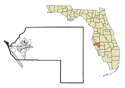 Location in Manatee County and the state of Florida | |
| Coordinates: 27°30′35″N 82°42′57″W[1] | |
| Country | |
| State | |
| County | Manatee |
| Settled | 1892 |
| Incorporated (city) | 1950 |
| Government | |
| • Type | Strong Mayor-Commission |
| • Mayor | Isabel Hambric |
| Area | |
| • Total | 1.91 sq mi (4.95 km2) |
| • Land | 1.68 sq mi (4.34 km2) |
| • Water | 0.23 sq mi (0.60 km2) |
| Elevation | 3 ft (0.9 m) |
| Population (2010) | |
| • Total | 3,836 |
| • Estimate (2019)[3] | 4,305 |
| • Density | 2,568.62/sq mi (991.62/km2) |
| Time zone | UTC-5 (Eastern (EST)) |
| • Summer (DST) | UTC-4 (EDT) |
| ZIP codes | 34217, 34218 |
| Area code(s) | 941 |
| FIPS code | 12-32150[4] |
| GNIS feature ID | 0284190[5] |
| Website | holmesbeachfl |
History
Holmes Beach was named for John E. Holmes, Sr., the property developer who started this planned community after World War II.[6] Holmes Beach would be incorporated on March 13, 1950 with 46 voting in favor, 13 against and 1 in abstention. Despite a request not to use anyone's name, Holmes Beach was decided on, although names such as Palm City, Mid-Island Beach, Coquina Beach and Tarpon Beach were considered as well.[7]
Manatee Public Beach located at the intersection of Manatee Avenue and Gulf Drive would open in 1952 originally as Manatee County Public Beach. It would be managed by a local Kiwanis Club chapter with all proceeds going to local charity related initiatives. During the 1950s & 1960s the beach was racially segregated like many others in the Southeastern United States.[8] It is not clear, however, when the beach was officially desegregated. The beach would be renamed Manatee Beach before being changed to Manatee Public Beach.[9]
Geography
According to the United States Census Bureau, the city has a total area of 1.91 square miles (4.9 km2), of which 1.68 square miles (4.4 km2) is land, and 0.23 square miles (0.60 km2) is water.
Key Royale
Included in the city limits is the adjacent bayside island of Key Royale, formerly known as School Key. It was uninhabited until 1960, when a bridge was built joining it to the Holmes Beach section of Anna Maria Island; development then began.[10]
Demographics
| Historical population | |||
|---|---|---|---|
| Census | Pop. | %± | |
| 1950 | 137 | — | |
| 1960 | 1,143 | 734.3% | |
| 1970 | 2,699 | 136.1% | |
| 1980 | 4,018 | 48.9% | |
| 1990 | 4,810 | 19.7% | |
| 2000 | 4,966 | 3.2% | |
| 2010 | 3,836 | −22.8% | |
| 2019 (est.) | 4,305 | [3] | 12.2% |
| U.S. Decennial Census[11] | |||
As of the 2000 U.S. Census, there were 4,966 people in 2,538 households, including 1,482 families, in the city.[4] The population density was 3,063.5 inhabitants per square mile (1,183.6/km2). There were 4,202 housing units at an average density of 2,592.2 per square mile (1,001.5/km2). The racial makeup of the city was 98.59% White, 0.12% African American, 0.12% Native American, 0.28% Asian, 0.08% Pacific Islander, 0.22% from other races, and 0.58% from two or more races. Hispanic or Latino of any race were 1.65% of the population.
Of the 2,538 households 13.7% had children under the age of 18 living with them, 49.2% were married couples living together, 6.5% had a female householder with no husband present, and 41.6% were non-families. 34.0% of households were one person and 17.8% were one person aged 65 or older. The average household size was 1.96 and the average family size was 2.44.
The age distribution was 12.9% under the age of 18, 2.8% from 18 to 24, 20.1% from 25 to 44, 31.0% from 45 to 64, and 33.2% 65 or older. The median age was 54 years. For every 100 females, there were 90.3 males. For every 100 females age 18 and over, there were 88.3 males.
The median household income was $45,074 and the median family income was $55,669. Males had a median income of $30,778 versus $25,825 for females. The per capita income for the city was $31,345. About 1.2% of families and 3.6% of the population were below the poverty line, including 2.3% of those under age 18 and 1.3% of those age 65 or over.
Notable people
- Kathleen Flinn, author
- Kit Klein, speed skater
- Don Maloney, author
- Trevor Peres, heavy metal musician
- Scott Rolen, baseball player
References
- "US Gazetteer files: 2010, 2000, and 1990". United States Census Bureau. February 12, 2011. Retrieved April 23, 2011.
- "2019 U.S. Gazetteer Files". United States Census Bureau. Retrieved July 2, 2020.
- "Population and Housing Unit Estimates". United States Census Bureau. May 24, 2020. Retrieved May 27, 2020.
- "U.S. Census website". United States Census Bureau. Retrieved January 31, 2008.
- "US Board on Geographic Names". United States Geological Survey. October 25, 2007. Retrieved January 31, 2008.
- Grimes, David (November 23, 1979). "The Legends Behind Manatee Names". Sarasota Herald-Tribune. pp. 3B. Retrieved June 6, 2015.
- "Back to the future in Holmes Beach". Anna Maria Island News. April 18, 2011. Retrieved October 17, 2020.
- Blakemore, Erin. "How Civil Rights Wade-Ins Desegregated Southern Beaches - HISTORY". www.history.com. Retrieved October 16, 2020.
- "Manatee County Public Beach Postcard". Manatee County Public Library System: Digital Collection. 1958. Retrieved October 16, 2020.
- City of Holmes Beach, Florida
- "Census of Population and Housing". U.S. Census Bureau. Retrieved January 22, 2019.
External links
- City of Holmes Beach official site
Municipalities and communities of Manatee County, Florida, United States | ||
|---|---|---|
| Cities | 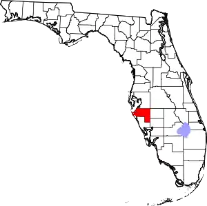 | |
| Town | ||
| CDPs | ||
| Unincorporated communities | ||
| Ghost towns | ||
| Footnotes | ‡This populated place also has portions in an adjacent county or counties | |
| ||
| Authority control |
|---|