Hopeland, Western Australia
Hopeland is an outer suburb of the Western Australian capital city of Perth, located in the Shire of Serpentine-Jarrahdale. In the 2016 census, it had a population of 336 people.[1] It was established in 1923 as Group 46 of the Group Settlement Scheme on Peel Estate; the name was in use for some time and it was established as a suburb name on 1 May 1997.[2]
| Hopeland Perth, Western Australia | |||||||||||||||
|---|---|---|---|---|---|---|---|---|---|---|---|---|---|---|---|
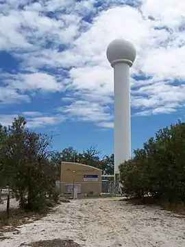 Serpentine weather radar, Hopeland | |||||||||||||||
 Hopeland | |||||||||||||||
| Coordinates | 32°23′17″S 115°51′4″E | ||||||||||||||
| Population | 336 (2016 census)[1] | ||||||||||||||
| Established | 1997 | ||||||||||||||
| Postcode(s) | 6125 | ||||||||||||||
| Location | |||||||||||||||
| LGA(s) | Shire of Serpentine-Jarrahdale | ||||||||||||||
| State electorate(s) | Darling Range | ||||||||||||||
| Federal Division(s) | Canning | ||||||||||||||
| |||||||||||||||
References
- Australian Bureau of Statistics (27 June 2017). "Hopeland (State Suburb)". 2016 Census QuickStats. Retrieved 27 September 2017.

- Western Australian Land Information Authority. "History of metropolitan suburb names – B". Retrieved 23 January 2021.
This article is issued from Wikipedia. The text is licensed under Creative Commons - Attribution - Sharealike. Additional terms may apply for the media files.