Howell Mountain, California
Howell Mountain (formerly, White Cottage)[2] is an unincorporated community in the Vaca Mountains, within Napa County, California.[1] It lies at an elevation of 1683 feet (513 m).[1]
Howell Mountain | |
|---|---|
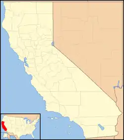 Howell Mountain Location in California  Howell Mountain Howell Mountain (the United States) | |
| Coordinates: 38°34′53″N 122°27′04″W | |
| Country | |
| State | |
| County | Napa County |
| Elevation | 1,683 ft (513 m) |
History
In August 2020, Howell Mountain was evacuated due to the Hennessey Fire, which resulted in the burning of over 315,000 acres (127,476 ha) in five counties, including near Howell Mountain.[3]
Geography
Howell Mountain is located 5.5 miles (8.9 km) north-northeast of Saint Helena.[2]
For census purposes, it forms part of the Angwin census-designated place.[2]
References
- U.S. Geological Survey Geographic Names Information System: Howell Mountain, California
- Durham, David L. (1998). California's Geographic Names: A Gazetteer of Historic and Modern Names of the State. Clovis, Calif.: Word Dancer Press. p. 644. ISBN 1-884995-14-4.
- "Hennessey Fire Information". CAL FIRE. Retrieved 17 August 2020.
Municipalities and communities of Napa County, California, United States | ||
|---|---|---|
| Cities and towns | 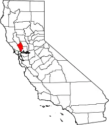 Napa County map | |
| CDPs | ||
| Unincorporated communities | ||
| Ghost towns |
| |
| ||
This article is issued from Wikipedia. The text is licensed under Creative Commons - Attribution - Sharealike. Additional terms may apply for the media files.