Hwapyong County
Hwapyong County is a kun, or county, in Chagang Province, North Korea. It was incorporated as a new county as part of a general reorganization of local government in December 1952. Previously it had been part of Chasong and Huchang.
Hwapyong County
화평군 | |
|---|---|
| Korean transcription(s) | |
| • Hancha | 和坪郡 |
| • McCune–Reischauer | Hwap'yŏng-gun |
| • Revised Romanization | Hwapyeong-gun |
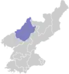
 Map of Chagang showing the location of Hwapyong | |
| Country | North Korea |
| Region | Kwanso |
| Province | Chagang |
| Administrative divisions | 1 ŭp, 3 rodongjagu, 10 ri |
| Area | |
| • Total | 1,219 km2 (471 sq mi) |
| Population (2008)[1] | |
| • Total | 42,183 |
Administrative divisions
Hwapyong-gun is divided into one town (ŭp), 3 workers' districts (rodongjagu) and 10 villages (ri).[2][3]
| Chosŏn'gŭl | Hancha | |
|---|---|---|
| Hwapyong-ŭp | 화평읍 | 和坪邑 |
| Kasan-rodongjagu | 가산로동자구 | 街山勞動者區 |
| Changbaeng-rodongjagu | 장백로동자구 | 長白勞動者區 |
| Chunghŭng-rodongjagu | 중흥로동자구 | 中興勞動者區 |
| Chinsong-ri | 진송리 | 榛松里 |
| Hoejung-ri | 회중리 | 檜中里 |
| Hŭksu-ri | 흑수리 | 黑水里 |
| Karim-ri | 가림리 | 街林里 |
| Punam-ri | 부남리 | 富南里 |
| Rip'yŏng-ri | 리평리 | 梨坪里 |
| Sobung-ri | 소북리 | 小北里 |
| Songdŏng-ri | 송덕리 | 松德里 |
| Taehŭng-ri | 대흥리 | 大興里 |
| Yanggye-ri | 양계리 | 陽溪里 |
References
- DPR Korean Central Bureau of Statistics: 2008 Population Census Archived May 14, 2011, at the Wayback Machine (Population 2008, published in 2009)
- "자강도 화평군 개요 - 북한지역정보넷". North Korean Human geography. The Institute for Peace Affairs. Archived from the original on 5 March 2016. Retrieved 26 February 2013.
- "화평군 - 북한지명사전". North Korea Net. JoongAng Ilbo. Retrieved 26 February 2013.
External links
- (in Korean) In Korean language online encyclopedias:
This article is issued from Wikipedia. The text is licensed under Creative Commons - Attribution - Sharealike. Additional terms may apply for the media files.
