I-n-Azaoua
I-n-Azaoua was a crude, French colonial-era redoubt built in February 1899[1] alongside an established well, three kilometres south of the current border line between Algeria and Niger.
I-n-Azaoua | |
|---|---|
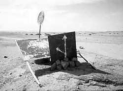 Important old sign 95km south of Tamanrasset on the main southbound In Guezzam route, indicating the fork heading ESE for I-n Azaoua well. | |
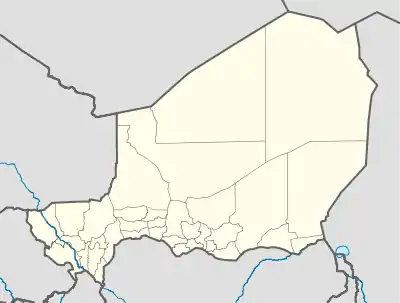 I-n-Azaoua Location in Niger | |
| Coordinates: 20°48′30″N 7°27′30″E | |
| Country | |
| Region | Agadez Region |
| Department | Arlit Department |
| Elevation | 1,670 ft (510 m) |
| Time zone | UTC+1 (WAT) |
History
During the French colonisation of north and west Africa, the Foureau-Lamy Mission of 1898-1900 constructed a small redoubt 800 metres from the well.[2] The 1972 Institut géographique national NG-32-II map indicates water at a depth of 6 metres. Once the easier trans-Sahara crossing via In Guezzam was established in the 1960s,[3] this remote 720-km track between Tamanrasset and Iferouane in Niger's northern Aïr Mountains became even less frequently used. As tourism grew in the 1970s, the remote Algerian part of the route to I-n Azaoua was closed by Algerian authorities and an important sign was erected 95 km south of Tamanrasset on the main In Guezzam route at the fork leading ESE for I-n Azaoua. Until that time, some travellers had mistakenly taken the I-n Azaoua route and perished.
