Illinois Route 123
Illinois Route 123 (IL-123) is an east–west state highway in central Illinois, USA. 33.72 miles (54.27 km) long,[1] it stretches from Historic Route 66 at Williamsville[3] to Illinois Route 125 near Pleasant Plains.
| ||||
|---|---|---|---|---|
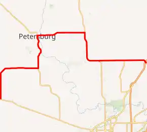
IL 123 highlighted in red | ||||
| Route information | ||||
| Maintained by IDOT | ||||
| Length | 33.72 mi[1] (54.27 km) | |||
| Existed | 1924[2]–present | |||
| Major junctions | ||||
| West end | ||||
| East end | ||||
| Location | ||||
| Counties | Sangamon, Menard | |||
| Highway system | ||||
| ||||

Route description
All of IL-123's route is contained within Sangamon and Menard counties. Major towns located on or adjacent to IL-123 include Athens, Petersburg, and Williamsville.
New Salem, the home of Abraham Lincoln in the 1830s, has been reconstructed as Lincoln's New Salem State Historic Site near Petersburg on IL-123.
History
SBI Route 123 was what Illinois 123 is now, plus a road from Ashland south to Alexander at Interstate 72/U.S. Route 36. In 1999, Illinois 123 was truncated on its southern end to Illinois 125. In October 2003, Illinois 123 was extended east to Williamsville, replacing some of Illinois Route 124 in the process as well as all of Sangamon County Route 11.[2]
Major intersections
| County | Location | mi[4] | km | Destinations | Notes |
|---|---|---|---|---|---|
| Menard | | 0.00 | 0.00 | Western terminus of IL 123 | |
| 9.4 | 15.1 | Southern end of IL 97 concurrency | |||
| Petersburg | 14.4 | 23.2 | Northern end of IL 97 concurrency | ||
| | 21.3 | 34.3 | Northern end of IL 29 concurrency | ||
| Sangamon | Fancy Creek Township | 27.0 | 43.5 | Southern end of IL 29 concurrency | |
| 30.6 | 49.2 | Western terminus of IL 124 | |||
| Williamsville | 33.72 | 54.27 | West end of Historic US 66 overlap | ||
| 34.0 | 54.7 | Eastern terminus of IL 123; east end of Historic US 66 overlap | |||
1.000 mi = 1.609 km; 1.000 km = 0.621 mi
| |||||
References
- Illinois Technology Transfer Center (2006). "T2 GIS Data". Retrieved 2007-11-08.
- Carlson, Rich. Illinois Highways Page: Routes 121 thru 140. Last updated March 15, 2005. Retrieved May 9, 2006.
- Google (October 3, 2020). "Street view of the eastern terminus of IL 123" (Map). Google Maps. Google. Retrieved October 3, 2020.
- Google (March 2, 2017). "Overview Map of IL 123" (Map). Google Maps. Google. Retrieved March 2, 2017.
