Illinois Route 5
Illinois Route 5 (IL 5) is a four-lane road in Rock Island County, Illinois, United States, that runs from U.S. Route 67 (US 67) in Rock Island to the interchange of Interstate 80 (I-80) and the toll-free portion of I-88, a distance of 15.78 miles (25.40 km).[1] IL 92 also continues eastbound on I-88.
| ||||
|---|---|---|---|---|
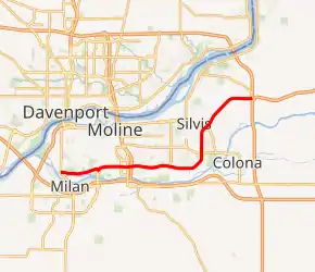
IL 5 highlighted in red | ||||
| Route information | ||||
| Maintained by IDOT | ||||
| Length | 15.78 mi[1] (25.40 km) | |||
| Existed | 1972[2]–present | |||
| Major junctions | ||||
| West end | ||||
| East end | ||||
| Location | ||||
| Counties | Rock Island | |||
| Highway system | ||||
| ||||

Route description
IL 5 is the main road on the north bank of the Rock River, and serves the cities of Rock Island, Moline, Silvis, and Carbon Cliff.
History
SBI Route 5 originally ran from East Dubuque to Chicago, mostly along the current US 20. The portion that ran from Belvidere through Rockford is now known as Charles Street in Rockford, and was superseded by what is now the expressway extension of the US 20 Rockford Bypass to Belvidere.
In 1972, IL 5 was applied on the former IL 190 and what was then the tolled portion of US 30. In 1975, IL 5 was designated as the East–West Tollway and extended to Rock Island, replacing some of IL 2 in the process. In 1990, IL 5 was changed over to I-88 east of I-80, while the portion of IL 5 in the Quad Cities remained.[2]
Major intersections
The entire route is in Rock Island County.
| Location | mi | km | Destinations | Notes | |
|---|---|---|---|---|---|
| Rock Island | 0.0 | 0.0 | Western terminus; western end of Great River Road Spur concurrency | ||
| Eastern end of Great River Road Spur concurrency | |||||
| Moline | 2.6 | 4.2 | 52nd Avenue – Milan (Milan Beltway) | Interchange; state maintained | |
| 5.1 | 8.2 | Cloverleaf interchange; I-74 exit 4 | |||
| Carbon Cliff | State maintained | ||||
| 12.2 | 19.6 | Interchange; western end of IL 92 concurrency | |||
| East Moline | 15.78 | 25.40 | Eastern terminus; signed as exits 1A (I-80 east) and 1B (I-80 west); eastern end of IL 92 concurrency; I-80 exit 4A | ||
| 1.000 mi = 1.609 km; 1.000 km = 0.621 mi | |||||
See also
 Illinois portal
 U.S. Roads portal
References
- Illinois Technology Transfer Center (2007). "T2 GIS Data". Retrieved 2007-11-08.
- Carlson, Rick. Illinois State Highways Page: Routes 1 thru 20. Last updated March 15, 2006. Retrieved March 24, 2006.
External links
 Media related to Illinois Route 5 at Wikimedia Commons
