Inari, Finland
Inari (Finnish pronunciation: [ˈinɑri]; Inari Sami: Aanaar; Skolt Sami: Aanar; Northern Sami: Anár; Norwegian and Swedish: Enare) is Finland's largest municipality (but one of the most sparsely populated), with four official languages, more than any other in the country. Its major sources of income are tourism, service industry and cold climate testing. With the Siida museum in the village of Inari, it is a center of Sami culture, widely known as the "capital of Sámi culture".[6][7] The airport in Ivalo and the country's key north-south European Route E75 (Finland's National Road 4) bring summer and winter vacationers seeking resorts with access to a well-preserved, uncrowded natural environment.
Inari
Inari – Aanaar – Aanar – Anár Enare | |
|---|---|
Municipality | |
| Inarin kunta Anár | |
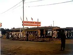 Lapland Shop in Inari in 1975 | |
 Coat of arms | |
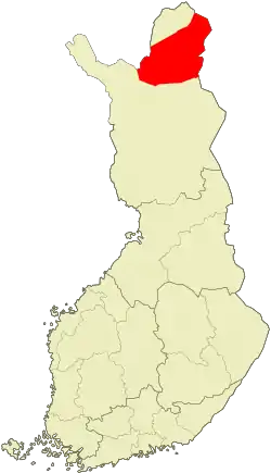 Location of Inari in Finland | |
| Coordinates: 68°54′18″N 027°01′49″E | |
| Country | |
| Region | Lapland |
| Sub-region | Northern Lapland |
| Charter | 1876 |
| Government | |
| • Municipal manager | Toni K. Laine |
| Area (2018-01-01)[1] | |
| • Total | 17,333.65 km2 (6,692.56 sq mi) |
| • Land | 15,052.36 km2 (5,811.75 sq mi) |
| • Water | 2,281.41 km2 (880.86 sq mi) |
| Area rank | Largest in Finland |
| Population (2020-07-31)[2] | |
| • Total | 6,855 |
| • Rank | 138th largest in Finland |
| • Density | 0.46/km2 (1.2/sq mi) |
| Population by native language | |
| • Finnish | 92.7% (official) |
| • Swedish | 0.2% |
| • Sami | 5.9% |
| • Others | 1.1% |
| Population by age | |
| • 0 to 14 | 13.8% |
| • 15 to 64 | 68.8% |
| • 65 or older | 17.4% |
| Time zone | UTC+02:00 (EET) |
| • Summer (DST) | UTC+03:00 (EEST) |
| Municipal tax rate[5] | 19% |
| Website | www.inari.fi |
Demographics
Population
The municipality of Inari has a population of 6,855 (31 July 2020).[2] The population density is 0.46 inhabitants per square kilometre (1.2/sq mi).
Its two largest villages are Ivalo and Inari. Other villages are Törmänen, Keväjärvi, Koppelo, Sevettijärvi–Näätämö, Saariselkä, Nellim, Angeli, Kaamanen, Kuttura, Lisma, Partakko, and Riutula.
Languages
The municipality has four official languages: Finnish, Inari Sami (ca. 400 estimated speakers), Skolt Sami (ca. 400 speakers), and Northern Sami (ca. 700 speakers). The estimates of how many people have some command of each of the Sami languages differ from the number of people who list them as their mother tongues. Of the total population of 6,863 in 2010, 6,366 people registered Finnish and 400 people registered one of the Sami languages as their mother tongue. Ninety-seven inhabitants were native speakers of other languages.
Citizenship
Only about 1%, 78 persons, were citizens of countries other than Finland in 2010.
Geography
Inari is the largest municipality in Finland. Located in Lapland, it covers an area of 17,333.65 square kilometres (6,692.56 sq mi),[1] of which 2,281.41 km2 (880.86 sq mi) is water. With an area of 1,043 km2 (403 sq mi), Lake Inari is the third largest lake in Finland, 40 km2 (15 sq mi) smaller than the country's second largest Lake Päijänne.
Finland's largest National Park Lemmenjoki is partly located in Inari, as is the Urho Kekkonen National Park. Vast parts of the municipality are designated wilderness areas: Hammastunturi, Muotkatunturi, Paistunturi, Kaldoaivi, Vätsäri, and Tsarmitunturi.
The village of Inari is Finland's northernmost holiday resort. The airport is located in the nearby village of Ivalo.
Inari has a chilly and humid climate with fairly cold winters and cool summers (Köppen Dfc). Due to the polar night, winter time temperatures are often severely cold. However, the midnight sun contributes to surprisingly high summertime temperatures. The warmest temperature ever recorded at Ivalo Airport was 31.8 °C (89.2 °F) in July 1925, while the coldest temperature on record was −48.9 °C (−56.0 °F) in January 1999. However, in July 1914 Thule weather station in western Inari recorded an unofficial record high temperature of 34.7 °C (94.5 °F), which is the highest temperature ever recorded in Lapland.[8] Inari is also among the driest locations in Finland, especially in the winter when the average precipitation total is less than half of the amount that Southern Finland receives. The driest year on record was 1941 when only 120,1 mm (4,7 inches) fell.[9]
| Climate data for Ivalo airport, 1981-2010 normals, extremes 1925- present | |||||||||||||
|---|---|---|---|---|---|---|---|---|---|---|---|---|---|
| Month | Jan | Feb | Mar | Apr | May | Jun | Jul | Aug | Sep | Oct | Nov | Dec | Year |
| Record high °C (°F) | 6.3 (43.3) |
6.9 (44.4) |
11.0 (51.8) |
16.4 (61.5) |
28.2 (82.8) |
31.7 (89.1) |
31.8 (89.2) |
31.4 (88.5) |
24.4 (75.9) |
12.8 (55.0) |
8.6 (47.5) |
7.4 (45.3) |
31.8 (89.2) |
| Average high °C (°F) | −8.5 (16.7) |
−7.7 (18.1) |
−2.6 (27.3) |
2.9 (37.2) |
8.9 (48.0) |
15.4 (59.7) |
18.8 (65.8) |
15.8 (60.4) |
9.9 (49.8) |
2.8 (37.0) |
−3.8 (25.2) |
−7.1 (19.2) |
3.7 (38.7) |
| Daily mean °C (°F) | −12.8 (9.0) |
−12.0 (10.4) |
−7.4 (18.7) |
−1.6 (29.1) |
4.5 (40.1) |
10.6 (51.1) |
14.0 (57.2) |
11.4 (52.5) |
6.2 (43.2) |
0.1 (32.2) |
−7.1 (19.2) |
−11.2 (11.8) |
−0.4 (31.3) |
| Average low °C (°F) | −17.5 (0.5) |
−16.8 (1.8) |
−12.5 (9.5) |
−6.5 (20.3) |
0.2 (32.4) |
6.1 (43.0) |
9.6 (49.3) |
7.3 (45.1) |
2.8 (37.0) |
−2.6 (27.3) |
−10.7 (12.7) |
−15.6 (3.9) |
−4.7 (23.5) |
| Record low °C (°F) | −48.9 (−56.0) |
−48.6 (−55.5) |
−39.9 (−39.8) |
−29.8 (−21.6) |
−15.8 (3.6) |
−3.3 (26.1) |
−0.1 (31.8) |
−3.5 (25.7) |
−11.6 (11.1) |
−27.6 (−17.7) |
−34.3 (−29.7) |
−42.0 (−43.6) |
−48.9 (−56.0) |
| Average precipitation mm (inches) | 23 (0.9) |
22 (0.9) |
22 (0.9) |
26 (1.0) |
38 (1.5) |
52 (2.0) |
75 (3.0) |
75 (3.0) |
46 (1.8) |
41 (1.6) |
28 (1.1) |
24 (0.9) |
472 (18.6) |
| Average precipitation days | 8 | 6 | 6 | 6 | 9 | 9 | 11 | 11 | 9 | 9 | 8 | 7 | 99 |
| Source 1: FMI climatological normals for Finland 1981-2010[10] | |||||||||||||
| Source 2: record highs and lows 1961- present[11] | |||||||||||||
Politics
Results of the 2011 Finnish parliamentary election in Inari:
- Centre Party 36.2%
- True Finns 19.2%
- Left Alliance 13.8%
- National Coalition Party 10.5%
- Social Democratic Party 9.8%
- Green League 6.6%
- Swedish People's Party 2.2%
- Christian Democrats 1.2%
- Other parties 0.5%
History
The municipality was established in 1876. It was claimed from about 1942 to 1945 by the Quisling regime during the Nazi occupation of Norway.[12]
Sites of interest
- Hammastunturi Wilderness Area
- Ivalo River
- Lemmenjoki National Park
- Siida, Sámi Museum and Northern Lapland Nature Centre
- Otsamo fell
- Urho Kekkonen National Park
References
- "Area of Finnish Municipalities 1.1.2018" (PDF). National Land Survey of Finland. Retrieved 30 January 2018.
- "Suomen virallinen tilasto (SVT): Väestön ennakkotilasto [verkkojulkaisu]. Heinäkuu 2020" (in Finnish). Statistics Finland. Retrieved 13 September 2020.
- "Population according to language and the number of foreigners and land area km2 by area as of 31 December 2008". Statistics Finland's PX-Web databases. Statistics Finland. Retrieved 29 March 2009.
- "Population according to age and gender by area as of 31 December 2008". Statistics Finland's PX-Web databases. Statistics Finland. Retrieved 28 April 2009.
- "List of municipal and parish tax rates in 2011". Tax Administration of Finland. 29 November 2010. Retrieved 13 March 2011.
- HS: Inarin kirkonkylästä tullut saamelaisten pääkaupunki (in Finnish)
- Saamenmaasta, kulttuurista ja mytologiasta – Rantapallo (in Finnish)
- Ilmatieteellinen Keskuslaitos:Suomen meteorologinen vuosikirja, 1914.
- "FMI normals 1981-2010" (PDF). fmi.fi. Retrieved 26 April 2016.
- "FMI open data". FMI. Retrieved 26 April 2016.
- Kurt D. Singer (1943). Duel for the northland: the war of enemy agents in Scandinavia. R. M. McBride & company. p. 200. Retrieved 2020-12-11.
External links
| Wikimedia Commons has media related to Inari. |
 Inari travel guide from Wikivoyage
- Municipality of Inari – Official website
| Municipalities |  | |
|---|---|---|
| Former municipalities | ||