Indiara
Indiara is a city and municipality in central-south Goiás state, Brazil. Indiara is a large producer of soybeans and cotton.
Indiara | |
|---|---|
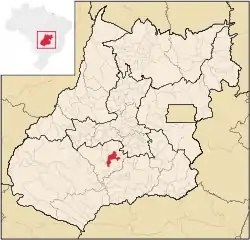 Location in Goiás state | |
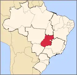
 Indiara Location in Brazil | |
| Coordinates: 17°08′30″S 49°59′41″W | |
| Country | Brazil |
| Region | Central-West |
| State | Goiás |
| Microregion | Vale do Rio dos Bois |
| Area | |
| • Total | 956.4 km2 (369.3 sq mi) |
| Elevation | 550 m (1,800 ft) |
| Population (2020 [1]) | |
| • Total | 15,787 |
| • Density | 17/km2 (43/sq mi) |
| Time zone | UTC-03:00 (BRT) |
| • Summer (DST) | UTC-02:00 (BRST) |
| Postal code | 75955-000 |
Location
Indiara is in the Vale do Rio dos Bois and has municipal boundaries with:
- north: Palmeiras de Goiás
- south: Edéia
- east: Cezarina
- west: Jandaia and Acreúna
Indiara is 102 kilometers (southwest) from the state capital, Goiânia and is on the edge of highway BR-060 (passing through Guapó and Cezarina).
Political data
- Eligible voters: 9,310 (12/2007)
- Mayor: José Vilmar da Fonseca (January 2005)
- Vice-mayor: Antônio Telesforo de Almeida
- Councilmembers: 9
Demographic data
- Population density: 13.28 inhabitants/km2 (2007)
- Population growth rate 2000/2007: 1.04%
- Urban population in 2007: 10,408
- Rural population in 2007: 2,295
Ranking on the municipal Human Development Index, 2000
- Municipal Human Development Index MHDI: 0.731
- State ranking: 143 (out of 242 municipalities)
- National ranking: 2,414 (out of 5,507 municipalities)[2]
Economy
The economy is based on cattle raising and agriculture. There are plantations of corn, rice, and soybeans. There are several small industries producing furniture, lumber, and clothes.
Economic data for 2007
- Industrial units: 20
- Retail commercial units: 123
- Banking institutions: Banco do Brasil S.A.
- Dairies: Cooperativa Mista dos Prod. de Leite de Morrinhos Ltda.
- Automobiles: 1,114 in 2007
Main agricultural activities
- Cattle raising: 75,140 head (2006)
- Agriculture: cotton, rice, sugarcane (1,125 hectares), oranges, corn (4,000 hectares), soybeans (7,000 hectares), and tomatoes.[3]
- Number of farms: 562
- Agricultural area: 83,013
- Planted area: 19,300
- Area in natural pasture: 45,292
- Workers in agriculture: 1,800
Education and health
- Literacy rate: 85.5% (2000)
- Infant mortality rate: 25.29 in 1,000 live births (2000)
- Schools: 13 (2006)
- Students: 3,428
- Hospitals: 3 (02/2007)
- Walk-in clinics: 1
History
The town began with the construction of the highway between Goiânia and Cuiabá, Mato Grosso in 1958. First came a restaurant, a "churrascaria" (steakhouse), and then other people began to arrive. There was no donation of lands; the landowners created the lots themselves. The town name comes from a coconut tree, the indaiá, which grows nearby. Indiara belonged to three municipalities: Edéia, Jandaia, and Palmeira de Goiás and was dismembered to create a district and a municipality in 1983.
References
- IBGE 2020
- Data are from 2000. For the complete list see Frigoletto Archived 2006-05-19 at the Wayback Machine
- Statistics are from Sepin Archived January 15, 2007, at the Wayback Machine.
Capital: Goiânia | |||||||||||||||||
|  | ||||||||||||||||
|
| |||||||||||||||||
| |||||||||||||||||
| |||||||||||||||||
