Isfield
Isfield is a small village and civil parish in the Wealden District of East Sussex in England, located north-east of Lewes.[3]
| Isfield | |
|---|---|
 Railway Station | |
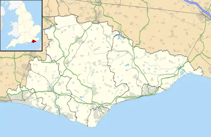 Isfield Location within East Sussex | |
| Area | 7.7 km2 (3.0 sq mi) [1] |
| Population | 574 (2011)[2] |
| • Density | 190/sq mi (73/km2) |
| OS grid reference | TQ451170 |
| • London | 40 miles (64 km) NNW |
| Civil parish |
|
| District | |
| Shire county | |
| Region | |
| Country | England |
| Sovereign state | United Kingdom |
| Post town | UCKFIELD |
| Postcode district | TN22 |
| Dialling code | 01825 |
| Police | Sussex |
| Fire | East Sussex |
| Ambulance | South East Coast |
| UK Parliament | |
History
The village of Isfield originally grew adjacent to the ford where the London to Lewes Way Roman road crossed the river River Ouse. The village had an active history through the Saxon, Norman eras, when a Norman castle motte was built on the river bank near the church to guard the crossing.[4] Local legend, as recalled by William Wratten, had it that King Harold spent the night before the Battle of Hastings in the village, at his demesne located where Isfield Place now stands.
Isfield became the home of John Shurley (died 1527), who was Cofferer of the Household to King Henry VIII. Isfield Place is a 17th-century manor house, incorporating part of the original 16th-century mansion of the Shurley family. Its design was influenced by Laughton Place nearby, following the marriage of Thomas Shurley, John's grandson, with Anne Pelham, daughter of Sir Nicholas Pelham of Laughton.
The herbalist Nicholas Culpeper spent his childhood in the village at the home of his grandfather, Rev. William Attersole, who was vicar at St Margaret's.
The area was heavily involved in the Wealden iron industry from the 15th century onwards.
Isfield again became a busy place in the 19th century. Much of its traffic was river-borne: coal and building materials, together with other produce, used the Ouse as its transport.[5] A paper-mill and a large flour-mill[6] both made use of the river.
Governance
Isfield Parish Council is the lowest level of government, above which are Wealden District Council and East Sussex County Council. It is in the Wealden parliamentary constituency in the House of Commons.
Geography
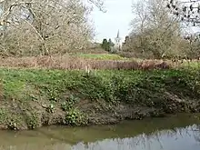
The parish of Isfield, stands on the flood-plain of the River Ouse,[7] at its confluence with the River Uck and a convenient crossing point, a ford, which the Romans used; the road through the village crosses the Uck by bridge, and the erstwhile Wealden Line did likewise. The main A26 road, while crossing the parish, runs to the East of the village. The land hereabouts is a floodplain of the rivers and streams.
The ancient ecclesiastical parish, which is very similar to the modern civil parish, was 1,822 acres (736 ha) in size. Today's population is relatively small. The village centre lies adjacent to the river crossing; a more modern part is further south.
Transport
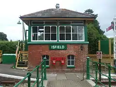
The A26 road, between Uckfield and Lewes, passes through the parish to the east of village. A remnant of the Wealden Line, the Lavender Line Steam Railway, is based here in the old Isfield Station. There is a campaign to reopen the line between Lewes and Uckfield.
Religion
The parish church is dedicated to St Margaret of Antioch. Within the church are tombs to the Shurley/Shirley family.[8]
Leisure, culture and sport
The Laughing Fish is a small public house with a garden.
References
- "East Sussex in Figures". East Sussex County Council. Retrieved 26 April 2008.
- "Civil Parish population 2011". Retrieved 8 October 2015.
- OS Explorer map Eastbourne and Beachy Head Scale: 1:25 000. Publisher:Ordnance Survey – Southampton B2 edition. Publishing Date:2009. ISBN 978 0319240823
- Geograph photograph
- Isfield history
- Isfield mill
- The Sussex River Ouse Archived 2008-04-20 at the Wayback Machine
- St Margaret's church
External links
![]() Media related to Isfield at Wikimedia Commons
Media related to Isfield at Wikimedia Commons