Isla del Frío
Isla del Frío is a small uninhabited island off the southern coast of Puerto Rico.[1] Together with Caja de Muertos, Gatas, Morrillito, Ratones, Cardona, and Isla de Jueyes, Isla del Frío is one of seven islands ascribed to the municipality of Ponce.[2][3][4] Like Isla de Jueyes, the island is considered part of barrio Vayas.[5]
.jpg.webp) Isla del Frio, Ponce, Puerto Rico, taken looking SW from the shores of the municipality of Juana Diaz | |
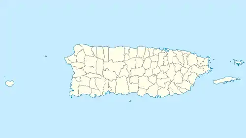
 Isla del Frío  Isla del Frío  Isla del Frío | |
| Geography | |
|---|---|
| Location | Ponce, Puerto Rico |
| Coordinates | 17°57′43″N 66°33′22″W |
| Area | 0.01 km2 (0.0039 sq mi) |
| Administration | |
| Commonwealth | Puerto Rico |
| Municipality | Ponce |
| Barrio | Vayas |
Location
The island, sometimes erroneously considered a cay (or, key), and sometimes erroneously spelled Isla del Erio,[6] is located approximately 980 feet (300 m) south of the mainland Puerto Rican shore at the mouth of Rio Inabon.[7] The closest populated point on the mainland is Hacienda Villa Esperanza, located in barrio Vayas; however the closest geographic point on the mainland is barrio Capitanejo in Ponce. The island has an area of 2.89 cuerdas[8] (one cuerda equals 0.97 acres[9]). It is located at latitude 17.96444° and longitude -66.55639°.[10]
Geography and climate
The island is a small 6-foot flat-topped island and consists mostly of brush.[11] The climate is dry and the island supports dry forest.
Nature reserve
Though not officially a nature reserve, the island is administered by the Puerto Rico Department of Natural and Environmental Resources.
References
- Isla del Frio. Puerto Rico Home Town Locator. United States Geological Survey. Retrieved 6 June 2011.
- Neysa Rodriguez Deynes. Brevario Sobre la Historia de Ponce. Second Edition. Government of the Autonomous Municipality of Ponce. 2002. Page 9. Printed by Impress Quality Printing, Bayamon, Puerto Rico.
- CityMelt. Retrieved 29 April 2011.
- Map of Ponce Municipio, Puerto Rico. United States Geological Survey. Home Town Locator. Retrieved 6 June 2011.
- Puerto Rico 2000: Population and Housing Unit Counts. U.S. Census Bureau. Publication Number PHC-3-53. Published November 2003. Page F-17. Retrieved 22 September 2011.
- El Boricua. Puerto Rican 101. Retrieved 29 April 2011.
- West Indies Pilot, Volume 1. United States Hydrographic Office. Page 592. Fourth Edition: 1922. Retrieved 29 April 2011.
- Neysa Rodriguez Deynes. Brevario Sobre la Historia de Ponce. Second Edition. Government of the Autonomous Municipality of Ponce. 2002. Page 9. Printed by Impress Quality Printing, Bayamon, Puerto Rico.
- UnitConversion.org Retrieved 29 April 2011.
- Isla del Frio. Traveling Luck. Retrieved 29 April 2011.
- West Indies Pilot, Volume 1. United States Hydrographic Office. Page 592. Fourth Edition: 1922. Retrieved 29 April 2011.