List of streets in Ponce, Puerto Rico
This article provides a listing, with brief descriptions, of the most traveled or best known streets and thoroughfares in Ponce, Puerto Rico. Unless otherwise noted, traffic is two-way. If traffic is two-way for the entire length of the street (as opposed to just a portion of its length), it is designated with the symbol "<->" under the column "Traffic direction"; otherwise, the dash symbol ("-") is used.
.jpg.webp)
Avenida Las Américas, looking east
Streets/Calles
| No. | Name | From | To | Length | # of lanes | Traffic direction | Notes | Photo |
|---|---|---|---|---|---|---|---|---|
| 1 | Avenida Las Américas | Puerto Rico Highway 500 (Puente San Antonio[1]) |
Boulevard Miguel Pou | 3.0 miles | 6 | W <-> E | Northern terminus becomes Ave. Fagot at Boulevar Miguel Pou | |
| 2 | Ponce Bypass | Carr. Pámpanos (PR-2R) | Ave. Ednita Nazario | 4.0 miles (est.) | 6 | W <-> E | Eastern end becomes Boulevar Miguel Pou. | .jpg.webp) |
| 3 | Avenida Santiago de los Caballeros | Ave. Tito Castro | Port of Ponce | 3.28 miles | 4-6 | N <-> S | Some segments are 4 lanes only | %252C_en_Ponce%252C_PR_(DSC01665).jpg.webp) |
| 4 | Bulevar Miguel Pou | Parque del Tricentenario /Puente de Los Leones |
Ave. Ednita Nazario | 1.5 miles (est.) | 4* | W <-> E | Eastern end turns into Ponce Bypass. | .jpg.webp) |
| 5 | Avenida Fagot | Puerto Rico Highway 10 | Boulevar Miguel Pou | 3.0 miles (est.) | 4 | N <-> S | Southern terminus becomes Ave. Las Américas at Bulevar Miguel Pou | .jpg.webp) |
| 6 | Avenida Tito Castro | Puerto Rico Highway 12 | Puerto Rico Highway 139 | 3.0 miles (est.) | 4 | W <-> E | Becomes C. Betances at the bridge over Río Portugués, where it becomes a one-lane, westbound street | %252C_Bo._Machuelo_Abajo%252C_Ponce%252C_Puerto_Rico%252C_mirando_al_oeste_(IMG_3417).jpg.webp) |
| 7 | Carretera Pámpanos (PR-2R) | C. Villa | Puerto Rico Highway 2 | 1.0 mile (est.) | 2 | N <-> S | ||
| 8 | Avenida Hostos[2] | C. Ferrocarril | Plaza de Recreo de la Playa | 2.5 miles (est.) | 2 | N <-> S | .jpg.webp) | |
| 9 | Avenida Muñoz Rivera | Ave. Las Américas | Puerto Rico Highway 2 | 0.5 mile (est.) | 2 | N <-> S | %252C_mirando_al_norte_(DSC03632B).jpg.webp) | |
| 10 | Calle Cantera (aka., "C. Mayor Cantera") | Puerto Rico Highway 10 | C. Marina | 0.5 mile (est.) | 2 | N - S | Traffic is one-way southbound from C. Tricoche (i.e., 1 block north of PR-14) to C. Marina (i.e., PR-123) | %252C_en_Barrio_Sexto%252C_en_Ponce%252C_PR%252C_mirando_hacia_el_norte_(IMG_3684).jpg.webp) |
| 11 | Calle Villa | Bridge over Rio Canas at entrance to Urb. Jardines del Caribe | Plaza Las Delicias | 2.0 miles | 2 | W - E | Traffic is eastbound one-way from Carr. Pámpanos to Plaza Las Delicias | .jpg.webp) |
| 12 | Calle Isabel | Plaza Muñoz Rivera | Parque del Tricentenario | 0.4 mile (est.) | 1-2 | W - E | Except for the one block from Plaza Muñoz Rivera to C. León, traffic is one-way westbound. | _en_Ponce%252C_PR_(DSC01696).jpg.webp) |
| 13 | Calle Comercio | Plaza Las Delicias | Ave. Santiago de los Caballeros | 1.2 miles (est.) | 1-2 | W - E | Traffic is eastbound from Plaza Las Delicias to C. Cruz | %252C_Barrio_San_Ant%C3%B3n%252C_Ponce%252C_Puerto_Rico%252C_mirando_al_este-sureste_(DSC03365).jpg.webp) |
| 14 | Calle Marina | Plaza Las Delicias | C. Ferrocarril | 0.4 mile (est.) | 1-2 | N - S | Traffic is northbound one-way north of C. Mayor to Plaza Las Delicias; South of Calle Mayor traffic is two-way; Southern end becomes Ave. Hostos at C. Ferrocarril | .jpg.webp) |
| 15 | Calle Atocha | C. Victoria | C. Isabel | 0.1 mile (est.) | 1 | N - S | Traffic is one-way northbound. | 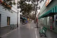 |
* Six (6) lanes when both frontage roads (or, "Calle Marginal") are considered.
C. = Calle/Street
Ave. = Avenida/Avenue
Carr. = Carretera/Road
| External audio | |
|---|---|
References
- Carmelo Rosario Natal. Ponce En Su Historia Moderna: 1945-2002. Published by Secretaría de Cultura y Turismo of the Government of the Autonomous Municipality of Ponce. Ponce, Puerto Rico. 2003. p. 251.
- Ave. Hostos was previously known as Camino Real. On 11 September 1903, it was renamed Ave. Eugenio Maria de Hostos. See: Eli D. Oquendo-Rodriguez. Pablo L. Crespo-Vargas, editor. "A Orillas del Mar Caribe: Boceto histórico de la Playa de Ponce - Desde sus primeros habitantes hasta principios del siglo XX." First edition. June 2017. Editorial Akelarre. Centro de Estudios e Investigaciones del Sur Oeste de Puerto Rico (CEISCO). Lajas, Puerto Rico. Page 48. ISBN 978-1547284931
External links
 Media related to Streets in Ponce, Puerto Rico at Wikimedia Commons
This article is issued from Wikipedia. The text is licensed under Creative Commons - Attribution - Sharealike. Additional terms may apply for the media files.