Itarsi
Itarsi is a city and municipality in Madhya Pradesh, India in Hoshangabad District.[2] Itarsi is a key hub for agricultural goods and is the biggest railway junction in Madhya Pradesh. Rail services from all 4 major metropolitan cities of India namely Mumbai to Calcutta and Delhi to Chennai pass through Itarsi.Itarsi has large number of agro-based industries and warehouses . Itarsi got its name by "eeta(eent)", (literally means brick in Hindi) and "rassi", (literally means rope in Hindi). Bricks and ropes had been made earlier in itarsi. It has Ordnance Factory.[3] The Bori Wildlife Sanctuary and Tawa Dam are nearby. Nearest airport Bhopal.
Itarsi | |
|---|---|
City | |
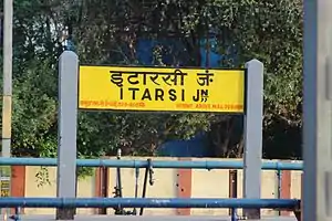
 ITARSI JN. | |
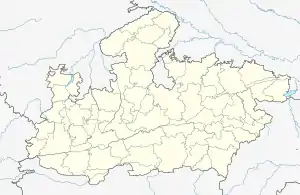
 Itarsi Location in Madhya Pradesh, India  Itarsi Itarsi (India) | |
| Coordinates: 22.62°N 77.75°E | |
| Country | |
| State | Madhya Pradesh |
| District | Hoshangabad |
| Government | |
| • MLA | Dr. Sita Sharan Sharma |
| Elevation | 350 m (1,150 ft) |
| Population (2011)[1] | |
| • Total | 99,330 |
| Languages | |
| • Official | Hindi |
| Time zone | UTC+5:30 (IST) |
| PIN | 461111 |
| Telephone code | 91 7572 |
| ISO 3166 code | IN-MP |
| Vehicle registration | MP-05 |
| Sex ratio | 1.08:1 ♂/♀ |
Geography
Itarsi is located at 22.62°N 77.75°E.[4] It has an average elevation of 304 metres (997 feet).
Itarsi Tehsil Population Statistics
Itarsi is a sub district in the Hoshangabad district, in the state of Madhya Pradesh. The total population in Itarsi sub district is 240,719 as per the survey of census during 2011 by Indian Government. Of this about 123,325 people are living in the urban (towns and cities) area and about 117,394 are living in villages (rural areas)
There are 49,297 House Holds in this sub district.
There are 124,898 males (52%); There are 115,821 females (48%). Itarsi also have Indian Ordinance Factory.
Demographics
As of 2011 India census,[5] Itarsi had a population of 114,495. Males constitute 52% of the population and females 48%. Itarsi has an average literacy rate of 75%, higher than the national average of 59.5%: male literacy is 81% and female literacy is 69%. In Itarsi, 13% of the population is under 6 years of age. Itarsi comes under "Constituents of Urban Agglomerations of Madhya Pradesh" includes Itarsi (M), Pathrauta (part) (OG), Bhilakhedi (CT) and Meharagaon (CT).
Administration
The city is a Tehsil under Hoshangabad District. It is a part of Hoshangabad Vidhan Sabha (legislative assembly) & comes under Hoshangabad - Narsinghpur Loksabha (Parliament) constituency. It has a municipality with 34 wards and headed by a municipality chairperson.
Transport
Itarsi Junction railway station
Itarsi is one of the biggest railway junction in Madhya Pradesh,India, at the crossing of important east-west and north-south routes. Itarsi comes under West Central Railway zone whose headquarters is in Jabalpur. Itarsi is connected via broad gauge lines to Bhopal and Delhi to the north, Bhusawal and Mumbai to the west, the railway junctions of Nagpur to the south and Jabalpur to the east. Rail services from Mumbai to Guwahati and Delhi to Chennai pass through Itarsi. 250 trains are daily passing through. Itarsi runs one express train — Vindhyachal express — and it runs three passenger trains in Jabalpur route daily. Itarsi is the busy railway station in Bhopal division. The new platforms 6 and 7 opened for Jabalpur, Nagpur and Bhusawal routes.
Apart from railway, National Highway (NH-69) connects Itarsi to major cities Bhopal and Nagpur. New Four lane roads are under the making in to be functional under 5 years. Four Duronto Express trains have technical halts at Itarsi.
Under construction project - * Itarsi-Bhusawal 3rd line. * Itarsi-nagpur 3rd line (Central Railway pushes Rs 140cr third line project in ghat section). * Itarsi-bhopal 3rd line. *
References
- "Itarsi Population". Retrieved 9 July 2017.
- "Itarsi Location Map, Where is Itarsi". www.mapsofindia.com. Retrieved 24 December 2016.
- "Indian Ordnance Factories: Ordnance Factory Itarsi". ofbindia.gov.in. Retrieved 24 December 2016.
- Falling Rain Genomics, Inc - Itarsi
- "Census of India 2001: Data from the 2001 Census, including cities, villages and towns (Provisional)". Census Commission of India. Archived from the original on 16 June 2004. Retrieved 1 November 2008.
