Jagatballavpur
Jagatballavpur is a census town in Jagatballavpur CD Block in Howrah Sadar subdivision of Howrah district in the Indian state of West Bengal.
Jagatballavpur | |
|---|---|
Census Town | |
 | |
 Jagatballavpur Location in West Bengal, India  Jagatballavpur Jagatballavpur (India) | |
| Coordinates: 22°41′11″N 88°6′25″E | |
| Country | |
| State | West Bengal |
| District | Howrah |
| Population (2011) | |
| • Total | 7,113 |
| Languages | |
| • Official | Bengali, English |
| Time zone | UTC+5:30 (IST) |
| Postal Code | 711408[1] |
| Vehicle registration | WB |
| Website | howrah |
Geography
Jagatballavpur is located at 22°41′11″N 88°6′25″E.[2]
Demographics
As per 2011 Census of India Jagatballavpur had a total population of 7,113 of which 3,636 (51%) were males and 3,477 (49%) were females. Population below 6 years was 786. The total number of literates in Jagatballavpur was 5,240 (82.82% of the population over 6 years).[3]
Transport
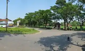
Jagatballavpur is a junction of four roads which lead to Bargachia, Masat, Jangipara and Udaynarayanpur.
Private Bus
- 9A Bargachia - Haripal railway station
- 26C Jagatballavpur - Bonhooghly
Bus Route Without Number
Train
Bargachia railway station on Howrah-Amta line is the nearest railway station of Jagatballavpur.
References
- "Jagatballavpur Pin code". pin-code.net. Retrieved 8 February 2021.
- "Jagatballavpur High School (Howrah district)". West Bengal. Wikimapia. Retrieved 15 May 2016.
- "C.D. Block Wise Primary Census Abstract Data(PCA)". 2011 census: West Bengal – District-wise CD Blocks. Registrar General and Census Commissioner, India. Retrieved 15 May 2016.
Cities, towns and locations in Howrah District | |
|---|---|
| Cities, municipal and census towns | |
| Locations other than cities and towns | |
| Related topics |
|
This article is issued from Wikipedia. The text is licensed under Creative Commons - Attribution - Sharealike. Additional terms may apply for the media files.
