Uluberia
Uluberia is a city and a municipality of Howrah district in the Indian state of West Bengal. It is the headquarters of the Uluberia subdivision. It is a part of the area covered by Kolkata Metropolitan Development Authority (KMDA).[2] This city is famous for its industrial belts.
Uluberia | |
|---|---|
City | |
 ESI Hospital, Uluberia | |
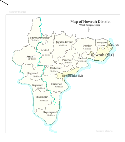
 Uluberia Location in West Bengal, India  Uluberia Uluberia (India) | |
| Coordinates: 22.47°N 88.11°E | |
| Country | |
| State | West Bengal |
| District | Howrah |
| Region | Greater Kolkata |
| Government | |
| • Type | Municipality |
| • Body | Uluberia Municipality |
| Area | |
| • Total | 34.10 km2 (13.17 sq mi) |
| Elevation | 1 m (3 ft) |
| Population (2011)[1] | |
| • Total | 232,290 |
| • Density | 6,800/km2 (18,000/sq mi) |
| Languages | |
| • Official | Bengali, English |
| Time zone | UTC+5:30 (IST) |
| Telephone code | +91 33 |
| Vehicle registration | WB |
| Lok Sabha constituency | Uluberia |
| Vidhan Sabha constituency | Uluberia Purba |
Geography
Uluberia is located at 22.47°N 88.11°E.[3] It has an average elevation of 1 m (3.3 ft). It is situated on the bank of River Hooghly. The main road passing through the heart of the city is Orissa Trunk Road & is also well connected by National Highway No-6; Bombay Road. This is an unplanned city and sometimes during heavy rains, may suffer from the drainage problems. The other problem is erosion of Hooghly River and encroachment in the main land.
Climate
| Climate data for Uluberia (1981–2010, extremes 1970–2012) | |||||||||||||
|---|---|---|---|---|---|---|---|---|---|---|---|---|---|
| Month | Jan | Feb | Mar | Apr | May | Jun | Jul | Aug | Sep | Oct | Nov | Dec | Year |
| Record high °C (°F) | 33.2 (91.8) |
36.4 (97.5) |
40.3 (104.5) |
41.0 (105.8) |
43.5 (110.3) |
43.3 (109.9) |
38.8 (101.8) |
35.8 (96.4) |
38.4 (101.1) |
37.7 (99.9) |
40.5 (104.9) |
33.8 (92.8) |
43.5 (110.3) |
| Average high °C (°F) | 24.6 (76.3) |
28.0 (82.4) |
31.9 (89.4) |
34.0 (93.2) |
34.2 (93.6) |
33.0 (91.4) |
31.8 (89.2) |
31.5 (88.7) |
31.5 (88.7) |
30.9 (87.6) |
28.4 (83.1) |
25.8 (78.4) |
30.5 (86.9) |
| Average low °C (°F) | 12.5 (54.5) |
16.3 (61.3) |
20.7 (69.3) |
23.9 (75.0) |
25.2 (77.4) |
25.9 (78.6) |
26.0 (78.8) |
26.1 (79.0) |
25.7 (78.3) |
23.7 (74.7) |
18.3 (64.9) |
13.9 (57.0) |
21.5 (70.7) |
| Record low °C (°F) | 7.2 (45.0) |
6.6 (43.9) |
10.8 (51.4) |
13.7 (56.7) |
16.7 (62.1) |
19.6 (67.3) |
20.7 (69.3) |
16.7 (62.1) |
20.8 (69.4) |
18.6 (65.5) |
10.4 (50.7) |
9.3 (48.7) |
6.6 (43.9) |
| Average rainfall mm (inches) | 10.6 (0.42) |
19.7 (0.78) |
31.9 (1.26) |
50.9 (2.00) |
115.8 (4.56) |
246.2 (9.69) |
367.4 (14.46) |
308.2 (12.13) |
288.0 (11.34) |
137.1 (5.40) |
33.4 (1.31) |
6.6 (0.26) |
1,615.6 (63.61) |
| Average rainy days | 1.0 | 1.5 | 1.8 | 3.4 | 6.1 | 11.6 | 15.8 | 15.6 | 12.5 | 6.5 | 1.5 | 0.5 | 77.9 |
| Average relative humidity (%) (at 17:30 IST) | 64 | 61 | 62 | 73 | 75 | 81 | 84 | 85 | 84 | 79 | 72 | 66 | 74 |
| Source: India Meteorological Department[4][5] | |||||||||||||
Demographics
As of 2001 India census,[6] Uluberia had a population of 202,095. Males constitute 52% of the population and females 48%. Uluberia has an average literacy rate of 64%, higher than the national average of 59.5%: male literacy is 70%, and female literacy is 58%. In Uluberia, 13% of the population is under 6 years of age.
With the partition of India there was a massive influx of refugees from East Pakistan into Kolkata and its peripheral areas. Of over a million refugees who entered West Bengal in 1950 alone settled mostly in squatter colonies between Naihati and Sonarpur on the east bank of the Hooghly and between Mogra and Uluberia on the west bank.[7]
Economy
Uluberia is an industrial town. In 2006 the Salim Group of Indonesia planned to invest $250 million in a motorcycle factory.
Transport
This city has National Highway 6, South Eastern Railway zone and Cuttack Road pass through it. The Hooghly River surrounds south part of this town. The town is served by Uluberia railway station.
External links
References
- "Uluberia City".
- "Base Map of Kolkata Metropolitan area". Kolkata Metropolitan Development Authority. Archived from the original on 28 September 2007. Retrieved 3 September 2007.
- Falling Rain Genomics, Inc - Uluberia
- "Station: Uluberia Climatological Table 1981–2010" (PDF). Climatological Normals 1981–2010. India Meteorological Department. January 2015. pp. 771–772. Archived from the original (PDF) on 5 February 2020. Retrieved 18 January 2021.
- "Extremes of Temperature & Rainfall for Indian Stations (Up to 2012)" (PDF). India Meteorological Department. December 2016. p. M241. Archived from the original (PDF) on 5 February 2020. Retrieved 18 January 2021.
- "Census of India 2001: Data from the 2001 Census, including cities, villages and towns (Provisional)". Census Commission of India. Archived from the original on 16 June 2004. Retrieved 1 November 2008.
- Chatterjee, Nilanjana, The East Bengal Refugees – A Lesson in Survival, in Calcutta, the Living City, Vol II, edited by Sukanta Chaudhuri, pp 74-75, Oxford University Press, ISBN 0-19-563697-X
Cities, towns and locations in Howrah District | |
|---|---|
| Cities, municipal and census towns | |
| Locations other than cities and towns | |
| Related topics |
|