Jagiroad
Jagiroad is a place located in Mayong Sub-Division, in Morigaon district of Assam state, India. It includes a paper mill (NPM) and World's biggest dry fish market. It was earlier known as Nakhola, but in British Rule of India, due to frequent confusion with the name Noakhali of Bangladesh, it was changed to Jagiroad because the road to Jagi, a place in Morigaon, passes through this place. The Tiwa (Lalung), Assamese and Bengali community form the majority in this area.
Jagiroad | |
|---|---|
city | |
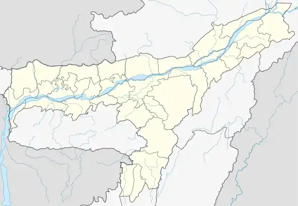
 Jagiroad Location in Assam, India  Jagiroad Jagiroad (India) | |
| Coordinates: 26.207815°N 92.406006°E | |
| Country | |
| State | Assam |
| District | Morigaon |
| Population (2011) | |
| • Total | 17,739 |
| Languages | |
| • Official | Tiwa and Assamese |
| Time zone | UTC+5:30 (IST) |
| PIN | 782410 |
| Telephone code | +913678 |
| Vehicle registration | AS 21 |

Jagiroad is centre of fish culture hatching and production of fish in Assam.
Demographics
As of 2011 India census, Jagiroad had a population of 17,739. Males constitute 52% of the population and females 48%. As of 2011 census there are 920 females per 1000 male in the census town. Jagiroad has an average literacy rate of 87%, male literacy is 91%, and female literacy is 74%. In Jagiroad, 10.3% of the population is under six years of age.
Total geographical area of Jagiroad census town is 12 km2, and it is the biggest census town by area in the sub district. Population density of the census town is 1431 persons per km2. There is only one ward in this census town which is Jagiroad Ward No 01.
Nearest railway station is Jagiroad which is within the census town. Mayong is the sub district headquarter and the distance from the census town is 8 km. District headquarters of the census town is Morigoan which is 25 km away. Dispur (Guwahati) is the state headquarters of the census town and is 65 km from here. Yearly average rainfall of the census town is 1399 mm. Maximum temperature here reaches up to 33 °C and minimum temperature goes down to 9 °C.
Jagiroad has 37% (6485) population engaged in either main or marginal works. 60% male and 11% female population are working population. 55% of total male population are main (full-time) workers and 5% are marginal (part-time) workers. For women 7% of total female population are main and 4% are marginal workers.
Politics
Jagiroad is part of Nowgong (Lok Sabha constituency).[1]
Transport
National Highway 37 (India) and the Guwahati–Lumding section operated by Indian Railways' North East Frontier Railway pass through Jagiroad. Jagiroad is also connected with Morigaon by Morigaon Road.
Jagiroad has also a railway station named Jagiroad Railway Station.
- Information about railway station
The Jagiroad railway station has 2 platforms. Many trains stops here to Dibrugarh and to Guwahati. You can also avail ticket from here from the ticket counter, which is situated a bit far.
From Jagiroad you can go to
- Chennai Egmore Railway Station
- Kolkata Chitpur Railway Station
- Old Delhi Junction Railway Station
- Guwahati Railway Station
- Dibrugarh Railway Station
- Lalgarh Junction Railway Station
- Rajendra Nagar Terminal Railway Station
- Anant Vihar Terminus Railway Station
- Malda Town Railway Station
- Lumding Junction Railway Station
- Badarpur Junction Railway Station
- Agartala Railway Station
- Katihar Railway Station
- New Jalpaiguri Railway Station
- Bandel Junction Railway Station
- Kamakhta Junction Railway Station
Industry
The Nagaon Paper Mill (NPM) was established in 1970. A unit of Hindustan Paper Corporation Ltd. which is situated on the National Highway 27 at Kagajnagar in Jagiroad. It is the first paper mill in the world to produce Kraft pulp in Kamyr Continuous Digester with 100% bamboo as raw material.
1000 TPD Cement grinding Unit - Alsthom Industries Limited was established in 2016. A Subsidiary of Dalmia Cement Bharat Limited. which is situated at Baghjap, Jagibhakatgaon in Jagiroad-Marigaon Road. It produces Cement with different grades and supplies across the states.
Education
Colleges
- Jagiroad College
- Jagiroad Junior College
- Ray Junior College
High schools
- Bapuji High School
- Jagiroad Higher Secondary School (10+2)
- N. F. Railway High School.(10)
- Indus Academy
- Nalanda Academy
- Sahid Lakhi Deka Higher Secondary School
- Jyotiniwas High School, Nizarapar (Jagiroad)
- Kendriya Vidyalaya, Jagiroad(10+2)
- Shankardev Vidya Niketan, Jagiroad
- Jagiroad Girl's High School
- HPC High School
Lower primary schools (Prathamik Vidyalaya)
These schools provide education up to standard for:
- Jagiroad Hindi Prathmic Vidyalaya
- Ghunusa Habi Prathamik Vidyalaya
- Nokhula Grant Prathamik Vidyalaya
- Bishnu Rava Nimna Buniyadi Prathamik Vidyalaya
- Tarak Chandra Prathamik Vidyalaya
- Indira Nagar Prathamik Vidyalaya
- Bhanu bidya mandir
- Bachpan Pre- School
- Kidzee
- Tegheria L.p. School
- Guripathar L.P. School
References
- "List of Parliamentary & Assembly Constituencies" (PDF). Assam. Election Commission of India. Archived from the original (PDF) on 4 May 2006. Retrieved 6 October 2008.
