Johnson Township, Gibson County, Indiana
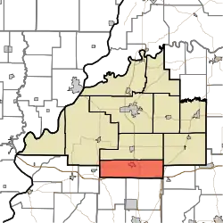
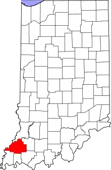
Johnson Township is one of ten townships in Gibson County, Indiana. As of the 2010 census, its population was 4,094 and it contained 1,605 housing units.[3]
Johnson Township Gibson County | |
|---|---|
 Location in Gibson County | |
| Coordinates: 38°11′40″N 87°34′31″W | |
| Country | United States |
| State | Indiana |
| County | Gibson |
| Township Seat | Haubstadt |
| School District | South Gibson School Corporation |
| Government | |
| • Type | Indiana township |
| • Trustee | Edward Pruitt |
| Area | |
| • Total | 40.64 sq mi (105.3 km2) |
| • Land | 40.53 sq mi (105.0 km2) |
| • Water | 0.11 sq mi (0.3 km2) |
| Elevation | 459 ft (140 m) |
| Population (2014) | |
| • Total | 4,195 |
| • Density | 103.22/sq mi (39.85/km2) |
| Time zone | UTC-6 (CST) |
| • Summer (DST) | UTC-5 (CDT) |
| ZIP code | 47639 |
| Area code(s) | 812 |
| FIPS code | 18-38682[2] |
| GNIS feature ID | 453512 |
| Fastest Growing Township in the county in population | |
Johnson Township was organized in 1823.[4]
Geography
According to the 2010 census, the township has a total area of 40.64 square miles (105.3 km2), of which 40.53 square miles (105.0 km2) (or 99.73%) is land and 0.11 square miles (0.28 km2) (or 0.27%) is water.[3]
Cities and towns
Unincorporated towns
Adjacent townships
- Gibson County
- Union Township (north)
- Barton Township (east)
- Montgomery Township (northwest)
- Posey County
- Smith Township (west)
- Vanderburgh County
- Armstrong Township (southwest)
- Scott Township (southeast)
- Warrick County
- Greer Township (east)
Cemeteries
The township contains four cemeteries: Nobles, Powell, Stunkel, Tabor and Williams.
Education
Johnson Township is served by the South Gibson School Corporation.
Public Schools
- Haubstadt Community School
Private Schools
- Saint James Catholic School - St. James
- Saints Peter and Paul Catholic School - Haubstadt
References
- "Johnson Township, Gibson County, Indiana". Geographic Names Information System. United States Geological Survey. Retrieved 2009-09-24.
- United States Census Bureau cartographic boundary files
- "US Board on Geographic Names". United States Geological Survey. 2007-10-25. Retrieved 2008-01-31.
- "U.S. Census website". United States Census Bureau. Retrieved 2008-01-31.
- "Population, Housing Units, Area, and Density: 2010 - County -- County Subdivision and Place -- 2010 Census Summary File 1". United States Census. Archived from the original on 2020-02-10. Retrieved 2013-05-10.
- History of Gibson County, Indiana: With Illustrations Descriptive of Its Scenery, and Biographical Sketches of Some of Its Prominent Men and Pioneers. Jas. T. Tartt & Co. 1884. p. 220.
This article is issued from Wikipedia. The text is licensed under Creative Commons - Attribution - Sharealike. Additional terms may apply for the media files.
