Jonestown, Lebanon County, Pennsylvania
Jonestown, previously known as Williamsburg, is a borough in Lebanon County, Pennsylvania, United States. It is part of the Lebanon Metropolitan Statistical Area. The population was 1,905 at the 2010 census.
Jonestown, Pennsylvania | |
|---|---|
Borough | |
 Location in Lebanon County, Pennsylvania | |
 Jonestown Location in Pennsylvania  Jonestown Location in the United States | |
| Coordinates: 40°24′50″N 76°28′45″W | |
| Country | United States |
| State | Pennsylvania |
| County | Lebanon |
| Settled | 1761 |
| Incorporated | 1870 |
| Government | |
| • Type | Borough Council |
| • Mayor | Joe Quairoli [1] |
| • Council President | Dawn Sellers |
| • Council Vice President | Robin Wolferd |
| Area | |
| • Total | 0.63 sq mi (1.64 km2) |
| • Land | 0.63 sq mi (1.64 km2) |
| • Water | 0.00 sq mi (0.00 km2) |
| Population (2010) | |
| • Total | 1,905 |
| • Estimate (2019)[3] | 2,028 |
| • Density | 3,198.74/sq mi (1,235.96/km2) |
| Time zone | UTC-5 (Eastern (EST)) |
| • Summer (DST) | UTC-4 (EDT) |
| ZIP code | 17038 |
| Area code(s) | 717 |
| FIPS code | 42-38400 |
| GNIS feature ID | 1215364 |
Geography
Jonestown is located at 40°24′50″N 76°28′45″W (40.414001, -76.479030).[4]
According to the United States Census Bureau, the borough has a total area of 0.6 square miles (1.6 km2), all of it land.

Jonestown is bordered to the north, east, and south by Swatara Township (2.4 mi), and to the west by Union Township (1.18 mi)
Demographics
| Historical population | |||
|---|---|---|---|
| Census | Pop. | %± | |
| 1880 | 703 | — | |
| 1890 | 643 | −8.5% | |
| 1900 | 571 | −11.2% | |
| 1910 | 603 | 5.6% | |
| 1920 | 580 | −3.8% | |
| 1930 | 624 | 7.6% | |
| 1940 | 721 | 15.5% | |
| 1950 | 853 | 18.3% | |
| 1960 | 813 | −4.7% | |
| 1970 | 954 | 17.3% | |
| 1980 | 814 | −14.7% | |
| 1990 | 931 | 14.4% | |
| 2000 | 1,028 | 10.4% | |
| 2010 | 1,905 | 85.3% | |
| 2019 (est.) | 2,028 | [3] | 6.5% |
| Sources:[5][6][7] | |||
As of the 2010 United States Census, there were 1,905 people living in the borough. The racial makeup of the borough was 89.9% White, 1.8% Black, 1.0% Asian, 0.4% from some other race and 1.3% from two or more races. 5.6% were Hispanic or Latino of any race.
As of the census[6] of 2000, there were 1,028 people, 402 households, and 272 families living in the borough. The population density was 1,597.0 people per square mile (620.2/km²). There were 418 housing units at an average density of 649.4 per square mile (252.2/km²). The racial makeup of the borough was 97.67% White, 1.26% African American, 0.19% Native American, 0.19% Asian, 0.58% from other races, and 0.10% from two or more races. Hispanic or Latino of any race were 1.85% of the population.
There were 402 households, out of which 34.1% had children under the age of 18 living with them, 52.5% were married couples living together, 12.2% had a female householder with no husband present, and 32.1% were non-families. 28.4% of all households were made up of individuals, and 7.2% had someone living alone who was 65 years of age or older. The average household size was 2.53 and the average family size was 3.12.
In the borough the population was spread out, with 27.2% under the age of 18, 8.0% from 18 to 24, 31.9% from 25 to 44, 21.3% from 45 to 64, and 11.6% who were 65 years of age or older. The median age was 35 years. For every 100 females there were 107.3 males. For every 100 females age 18 and over, there were 98.9 males.
The median income for a household in the borough was $36,000, and the median income for a family was $45,208. Males had a median income of $30,700 versus $20,724 for females. The per capita income for the borough was $15,322. About 6.9% of families and 9.7% of the population were below the poverty line, including 14.8% of those under age 18 and 6.5% of those age 65 or over.
References
- "Jonestown Borough Directory". Archived from the original on April 15, 2012. Retrieved December 1, 2011.
- "2019 U.S. Gazetteer Files". United States Census Bureau. Retrieved July 28, 2020.
- "Population and Housing Unit Estimates". United States Census Bureau. May 24, 2020. Retrieved May 27, 2020.
- "US Gazetteer files: 2010, 2000, and 1990". United States Census Bureau. 2011-02-12. Retrieved 2011-04-23.
- "Census of Population and Housing". U.S. Census Bureau. Retrieved 11 December 2013.
- "U.S. Census website". United States Census Bureau. Retrieved 2008-01-31.
- "Incorporated Places and Minor Civil Divisions Datasets: Subcounty Resident Population Estimates: April 1, 2010 to July 1, 2012". Population Estimates. U.S. Census Bureau. Archived from the original on 11 June 2013. Retrieved 11 December 2013.
Municipalities and communities of Lebanon County, Pennsylvania, United States | ||
|---|---|---|
| City | 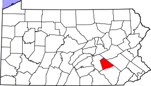 | |
| Boroughs | ||
| Townships | ||
| CDPs | ||
| Unincorporated communities | ||
| ||
| Authority control |
|---|