Joondalup (suburb)
Joondalup is a suburb of the regional City of Joondalup in Perth, Western Australia, which includes the city's central business district as well as the council chambers for the local authority.
| Joondalup Perth, Western Australia | |||||||||||||||
|---|---|---|---|---|---|---|---|---|---|---|---|---|---|---|---|
 Davidson Terrace, Joondalup | |||||||||||||||
 Joondalup | |||||||||||||||
| Coordinates | 31.745°S 115.766°E | ||||||||||||||
| Population | 9,090 (2016 census)[1] | ||||||||||||||
| • Density | 770/km2 (1,995/sq mi) | ||||||||||||||
| Established | 1980s | ||||||||||||||
| Postcode(s) | 6027 | ||||||||||||||
| Area | 11.8 km2 (4.6 sq mi) | ||||||||||||||
| Location | 26 km (16 mi) from Perth | ||||||||||||||
| LGA(s) | City of Joondalup | ||||||||||||||
| State electorate(s) | Joondalup | ||||||||||||||
| Federal Division(s) | Moore | ||||||||||||||
| |||||||||||||||
History
The suburb is named after Lake Joondalup, on the banks of which the suburb resides. The name Joondalup is a Noongar word, first recorded in 1837 and possibly meaning either "place of whiteness or glistening", or "place of a creature that can only move backwards".[2]
Geography
Joondalup is bounded by Burns Beach Road to the north, Mitchell Freeway to the west, Eddystone and Lakeside Drives to the south and Lake Joondalup to the east. Grand Boulevard and Joondalup Drive run through the centre of Joondalup. Most of Joondalup is zoned commercial or residential, although a significant suburban area exists between Moore Drive and Burns Beach Road near Currambine train station, and some small residential estates have been built in recent years along Lakeside Drive. The Yellagonga Regional Park and a small bushland corridor near the TAFE and university campuses can be found in the east and south.[3]
Communities
Most of the residential housing in the city centre consists of either townhouses or apartments. There is a suburban residential area in the north-west corner of Joondalup, bordering the suburb of Currambine. It consists of a few hundred houses, numerous parks and Candlewood Village, a small shopping centre.
Demographics
In the 2016 census, there were 9,090 people in Joondalup. 46.4% of people were born in Australia. The next most common countries of birth were England 15.3%, New Zealand 3.8%, South Africa 3.3%, Scotland 2.1% and India 2.0%. 73.5% of people spoke only English at home. Other languages spoken at home included Mandarin 3.0%, Arabic 1.9% and Afrikaans 1.3%.
Religion
The most common responses for religion were No Religion 34.5%, Catholic 17.6% and Anglican 13.4%.[1]
Economy
Retail
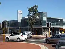
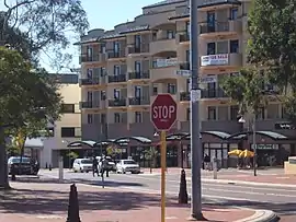
Joondalup's central business district, centred on Grand Boulevard, is largely a shopping and retail area lined with townhouses and apartments. Lakeside Joondalup is located adjacent to the Joondalup railway station and backs onto Grand Boulevard. Originally opened in 1994, it underwent considerable expansion from 2006 onwards, with several new shops and a food court opening on 7 December 2007, and the final stage on 4 December 2008. Also an expansion with a Myer department store opened in 20 November 2014 and the final stage opened early 2015.
Reconfiguration of the current centre will result in the inclusion of a further two mini-major, a new food court in addition to the current food court and an increase in the floor space of the Coles supermarket. The centre contains branches of the Myer Woolworths, Coles and IGA supermarkets and Target, Kmart and Big W variety and discount stores, as-well as mini majors JB-HiFi Rebel Sport H&M and Best & Less. With one of Western Australia's first ALDI Food Market opening June 2016.
Culture and contemporary life
Joondalup is a popular city for nightlife at weekends. The CBD contains two major nightclubs, Crush and Dusk, as well as four pubs around the city, The Old Bailey, the Grand Boulevard Tavern, The Sovereign Arms.
Sports
Arena Joondalup, located northwest of Lakeside Centre, is the home ground for one of Perth's oldest WAFL clubs, the West Perth Football Club, which moved from West Perth in the 1990s with their latest premiership coming in 2003 over rivals Subiaco. The Arena also hosts music events and festivals during the year, as well as the Home and Lifestyle Expo, an annual exhibition held in late March to early April.
Parks and greenspace
The city has a number of parks including Central Park and Neil Hawkins Park in the Yellagonga Regional Park. The Neil Hawkins Park is home to many parrots, including the Australian ringneck, cockatoos and kangaroos. The park sits alongside Lake Joondalup and wetlands which stretches out between Burns Beach Road to the north and Ocean Reef Road to the south. These wetlands provide refuge for migratory birds.
Law and government
Government
The suburb of Joondalup falls under the local government of the City of Joondalup and is represented by two councillors from the North Ward. The current councillors are Kerry Hollywood and Tom McLean.[4] The council chambers for the City of Joondalup are located in Joondalup's central business district. The complex includes Joondalup Library, which serves as the central library and local history centre for both the City of Joondalup and the City of Wanneroo local authorities. At state parliament level, Joondalup is represented in the Western Australian Legislative Assembly by a member from Joondalup electoral district. The current member is Emily Hamilton. In the Australian federal parliament, the suburb is part of the Division of Moore and is currently represented by member, Ian Goodenough.
Law
The Western Australia Police Force has a police station based in Joondalup and covers their Joondalup District.[5]
The WA Magistrates Court has metropolitan court based in Joondalup that deals with both criminal offences and civil claims for debt or damages and non-offences.[6]
Education
Schools
Joondalup contains the following primary and secondary educational institutions:
- Joondalup Primary School[7] (opened 1993)
- Lake Joondalup Baptist College (K-12, opened 1990)
Colleges and universities
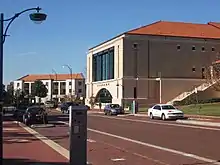
The Joondalup suburb is a major location for tertiary education in the northern suburbs and is known as the Joondalup Learning Precinct. The North Metropolitan TAFE has a campus in Joondalup providing state government education to meet the demands of students wanting to enter the workforce with up-to-date, industry-specific, practical skills. It was previously called the West Coast Institute of Training.
Edith Cowan University has a major campus based in the suburb. It offers graduate and post graduate degrees on the campus that also includes, libraries, guilds, commercial shops, sporting facilities, and student housing.
Situated in the same Joondalup Learning Precinct as ECU and the TAFE campuses is the West Australian Police Academy. The Western Australia Police's training academy was moved from Maylands to Joondalup and was officially opened on 15 February 2002.[8]
Infrastructure
Roads
The suburb of Joondalup has three interchanges to the State Route 2, Mitchell Freeway on Hodges Drive, Shenton Avenue and Burns Beach Road. The other major route through the suburb is State Route 85, Joondalup Drive which leads to the Tonkin Highway and when completed, the Brand Highway and Great Northern Highway.
Rail
The Joondalup train station and bus interchange is located next to and connected to Lakeside Joondalup Shopping City. The interchange is connected to the Transperth train network linking the area to the Perth CBD - a 25-minute journey - and to Butler railway station the terminus of the line. For a few months in early 1993, Joondalup was the terminus of the railway, and is part of the Joondalup Line.[9]
Bus
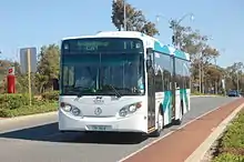
There two types of bus services in the suburb. A free service called the CAT buses (routes 10 and 11) which travel a circular route around Joondalup's central area, ferrying passengers to Joondalup Health Campus, Edith Cowan University, North Metropolitan TAFE and Joondalup CBD among other destinations.
The residential part of the suburb to the north is serviced by the Transperth buses on routes 468 (Whitfords station to Joondalup station) and 473 (Kinross to Joondalup station).
Health systems
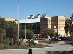
The Joondalup Health Campus, the major public hospital for Perth's northern suburbs. It is both a public and private hospital and is managed by Ramsay Health Care. The suburb is home to other health providers and specialists that surround the health campus.
References
- Australian Bureau of Statistics (27 June 2017). "Joondalup (State Suburb)". 2016 Census QuickStats. Retrieved 23 July 2019.

- Western Australian Land Information Authority. "History of metropolitan suburb names – J". Retrieved 17 January 2007..
- 2006 StreetSmart Perth street directory, Department of Land Information, Western Australia.
- "Ward map – City of Joondalup". Retrieved 11 August 2020.
- Police, Western Australia. "Your Local Police". Western Australia Police. Retrieved 11 August 2020.
- Court, Magistrates. "Court Locations and Contacts". www.magistratescourt.wa.gov.au. Retrieved 11 August 2020.
- http://www.joondalupps.wa.edu.au
- "Western Australia Police Academy". Western Australia Police. Retrieved 11 August 2020.
- History of Stations on the Clarkson Train Line Right Track