K-117 (Kansas highway)
K-117 is a 11.977-mile-long (19.275 km) state highway in the U.S. state of Kansas. K-117's southern terminus is at U.S. Route 36 (US-36) in Midway south of Herndon, and the northern terminus is a continuation as Nebraska Highway 17 (N-17) at the Nebraska border north of Herndon.[3]
| ||||
|---|---|---|---|---|
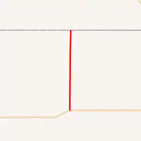
K-117 highlighted in red | ||||
| Route information | ||||
| Maintained by KDOT | ||||
| Length | 11.977 mi[1] (19.275 km) | |||
| Existed | May 16, 1937[2]–present | |||
| Major junctions | ||||
| South end | ||||
| North end | ||||
| Location | ||||
| Counties | Rawlins | |||
| Highway system | ||||
| ||||

K-117 was first designated as a state highway on May 26, 1937, to connect to the new highway that was constructed by the Nebraska Department of Transportation (NDOT). K-117's alignment has not changed since it was designated.
Route description
K-117 begins at an intersection with US-36 in Midway and begins traveling north and after roughly two miles (3.2 km) crosses and unnamed creek. Approximately 3.4 miles (5.5 km) past the creek, the road crosses a BNSF Railway just east of Herndon. The highway continues north and after about .6 miles (0.97 km) intersects County Route 314 (CR-314) also known as Rural Secondary (RS-675). It continues northward for roughly another six miles (9.7 km) and reaches the Nebraska border where it continues as N-17.[3]
The Kansas Department of Transportation (KDOT) tracks the traffic levels on its highways, and in 2017, they determined that on average the traffic varied from 215 vehicles slightly north of Herndon to 265 vehicles south of Herndon.[4] K-117 is not included in the National Highway System.[5] The National Highway System is a system of highways important to the nation's defense, economy, and mobility. K-117 doesn't connect to the National Highway System either.[6]
History
In 1936, the Nebraska Department of Transportation (NDOT) built a new state highway from US-6 in Culbertson, Nebraska southward to the Kansas border. In a January meeting of that same year, the KDOT approved that when NDOT completes the highway, a new highway would be built from US-36 northward to connect to the new highway. Then K-117 was assigned by the Kansas Department of Transportation (KDOT) in a May 26, 1937 resolution, and its alignment has not changed since.[2][7]
Major intersections
The entire route is in Rawlins County.
| Location | mi[1] | km | Destinations | Notes | |
|---|---|---|---|---|---|
| Midway | 0.000 | 0.000 | Southern terminus | ||
| Richland Township | 11.977 | 19.275 | Continuation at the Nebraska border | ||
| 1.000 mi = 1.609 km; 1.000 km = 0.621 mi | |||||
References
- Kansas Department of Transportation (2016). "Pavement Management Information System". Kansas Department of Transportation. Retrieved April 15, 2019.
- State Highway Commission of Kansas (May 26, 1937). "Resolution establishing a road in Rawlins County as a part of the State Highway System". Topeka: State Highway Commission of Kansas. Retrieved July 30, 2019.
- Bureau of Transportation Planning (2009). Rawlins County (PDF) (Map). Scale not given. General Highway Map. Topeka: Kansas Department of Transportation. Retrieved July 29, 2019.
- Bureau of Transportation Planning (2018). Traffic Flow Map Kansas State Highway System (PDF) (Map). [c. 1:1,584,000]. Topeka: Kansas Department of Transportation. Retrieved July 29, 2019.
- Federal Highway Administration (May 8, 2019). National Highway System: Kansas (PDF) (Map). [c. 1:3,900,000]. Federal Highway Administration. Retrieved July 29, 2019.
- Natzke, Stefan; Neathery, Mike; Adderly, Kevin (September 26, 2012). "What is the National Highway System?". National Highway System. Federal Highway Administration. Retrieved July 29, 2019.
- Bureau of Transportation Planning (2019–2020). Kansas State Highway System (PDF) (Map). Scale not given. Topeka: Kansas Department of Transportation. Retrieved June 10, 2020.