K-144 (Kansas highway)
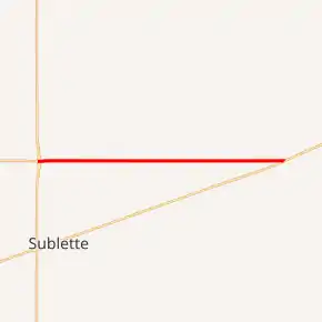
K-144 is a 16.825-mile-long (27.077 km) east–west state highway in the U.S. state of Kansas. K-144's western terminus is at a diamond interchange with U.S. Route 83 (US-83) and US-160 north-northwest of the City of Sublette and the eastern terminus is at US-56 northeast of the City of Copeland. K-144 travels through flat rural farmlands and is a two-lane road its entire length.
| ||||
|---|---|---|---|---|
K-144 highlighted in red | ||||
| Route information | ||||
| Maintained by KDOT | ||||
| Length | 16.825 mi[1] (27.077 km) | |||
| Existed | September 25, 1957[2]–present | |||
| Major junctions | ||||
| West end | ||||
| East end | ||||
| Location | ||||
| Counties | Haskell, Gray | |||
| Highway system | ||||
| ||||

In a May 9, 1956 meeting, it was approved to add K-144 to the state highway system as soon as Haskell and Gray counties had brought the road up to state highway standards. By late 1957, required projects were complete and on September 25, 1957, K-144 was designated as a state highway. Between 2016 and 2017, the junction with US-83 and US-160 was converted to a diamond interchange as part of a project to expand US-83.
Route description
K-144 begins at a diamond interchange with US-83 and US-160 north-northwest of Sublette. From here the highway begins traveling eastward through flat rural farmlands. After about eight miles (13 km) it reaches an intersection with County Road Uu, also known as Rural Secondary 940 (RS-940), which travels south to US-56. From here it continues another two miles (3.2 km) before reaching an intersection with County Road Ww (RS-941). It continues eastward and after another two miles (3.2 km) it crosses into Gray County.[3] About 1 mile (1.6 km) into Gray County it intersects RS-285, also known as Plains Road or Dice Street. From here it continues for another 3.8 miles (6.1 km) through flat rural farmlands before reaching an at grade crossing with a Cimarron Valley Railroad track then intersecting its eastern terminus at US-56.[4][5]
The Kansas Department of Transportation (KDOT) tracks the traffic levels on its highways, and in 2017, they determined that on average the traffic varied from 775 vehicles per day near the western terminus to 865 vehicles per day near the eastern terminus.[6] K-144 is not included in the National Highway System.[7] The National Highway System is a system of highways important to the nation's defense, economy, and mobility. K-144 does connect to the National Highway System at its western terminus at US-83 / US-160.[8]
History
The route was first authorized by the State Highway Commission of Kansas, now known as KDOT, in a May 9, 1956 meeting, as soon as Haskell and Gray counties had brought the road up to state highway standards.[2]:2–3 Then by mid 1957, the counties had finished projects to bring the road up to state highway standards and on September 25, 1957, it was designated as K-144.[2]:1 When first planned, the eastern terminus was K-45, but was redesignated as US-56 by the time K-144 was established.[9]
In a July 2010 study, US-83 was planned to be reconstructed from Sublette to Scott City and included plans for a diamond interchange to be built at the K-144 intersection.[10]:40–41 On February 2016, KDOT accepted a bid of $22.3 million (equivalent to $23.8 million in 2021) to convert the western terminus to a diamond interchange as well as reconstruct a 6-mile (9.7 km) section of US-83.[11] On June 26, 2017, K-144 was closed and on June 27, 2017, US-160 was closed from K-190 east to K-144 to allow work to begin to realign US-160 and K-144 with the new overpass.[12] On September 20, 2017, US-160 and K-144 reopened, with only minor work remaining to complete the entire project.[13]
Major intersections
| County | Location | mi[1] | km | Destinations | Notes |
|---|---|---|---|---|---|
| Haskell | Haskell Township | 0.000 | 0.000 | Continuation past US-83 | |
| Western terminus; diamond interchange | |||||
| Gray | Copeland Township | 16.825 | 27.077 | Eastern terminus | |
| 1.000 mi = 1.609 km; 1.000 km = 0.621 mi | |||||
References
- Staff (2016). "Pavement Management Information System". Kansas Department of Transportation. Retrieved April 16, 2017.
- State Highway Commission of Kansas (September 25, 1957). "Certification by State Highway Engineer covering addition of road in Gray County to the State Highway System K-144". Topeka: State Highway Commission of Kansas. Retrieved August 23, 2019.
- Bureau of Transportation Planning (November 2008). Haskell County (PDF) (Map). [c. 1: 211,200]. General Highway Map. Topeka: Kansas Department of Transportation. Retrieved August 16, 2020.
- Bureau of Transportation Planning (December 2008). Gray County (PDF) (Map). [c. 1: 211,200]. General Highway Map. Topeka: Kansas Department of Transportation. Retrieved August 16, 2020.
- Google (August 16, 2020). "Overview map of K-144" (Map). Google Maps. Google. Retrieved August 16, 2020.
- Bureau of Transportation Planning (2018). Traffic Flow Map Kansas State Highway System (PDF) (Map). [c. 1:1,584,000]. Topeka: Kansas Department of Transportation. Retrieved July 29, 2019.
- Federal Highway Administration (May 8, 2019). National Highway System: Kansas (PDF) (Map). [c. 1:3,900,000]. Federal Highway Administration. Retrieved July 29, 2019.
- Natzke, Stefan; Neathery, Mike; Adderly, Kevin (September 26, 2012). "What is the National Highway System?". National Highway System. Federal Highway Administration. Retrieved July 29, 2019.
- "Chronological History Documentation: US 56 (correspondence between ODOT, AASHO, and other DOTs)" (PDF). Oklahoma Department of Transportation. Retrieved January 11, 2021.
- Kansas Department of Transportation (July 2010). "83-106 KA-1008-01; Haskell, Finney, & Scott counties US-83 Projects Identification & needs study" (PDF). Topeka: Kansas Department of Transportation. Retrieved August 16, 2020.
- Kansas Department of Transportation (February 10, 2016). "Bid approved for US-83 expansion project in Haskell County" (PDF). Topeka: Kansas Department of Transportation. Retrieved January 11, 2021.
- Kansas Department of Transportation (June 20, 2017). "Detours Ahead as KDOT works to tie U.S. 160 and K-144 into new Overpass Exchange in Haskell County" (PDF). Topeka: Kansas Department of Transportation. Retrieved January 11, 2021.
- Kansas Department of Transportation (September 20, 2017). "U.S. 160/K-144 reopen in Haskell County" (PDF). Topeka: Kansas Department of Transportation. Retrieved January 11, 2021.