K-208 (Kansas highway)
K-208 was a 0.201-mile-long (0.323 km) state highway in the U.S. state of Kansas. K-208's southern terminus was at K-4 in Valley Falls and the northern terminus was at K-16 in Valley Falls. K-208 was first designated as a state highway in 1961, from K-4 to K-16. Then in 1967, K-208 was decommissioned and became locally maintained.
| ||||
|---|---|---|---|---|
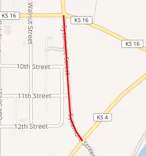
Former K-208 highlighted in red | ||||
| Route information | ||||
| Length | 0.201 mi[1] (0.323 km) | |||
| Existed | July 12, 1961[1]–April 21, 1967[2] | |||
| Major junctions | ||||
| South end | ||||
| North end | ||||
| Location | ||||
| Counties | Jefferson | |||
| Highway system | ||||
| ||||
.svg.png.webp)
History
K-208 was first designated as a state highway on July 12, 1961, to a highway connecting K-4 to K-16.[1] In an April 21, 1967 resolution, K-4 and K-16 were realigned in and around Valley Falls to make way for the new Perry Reservoir. Also at this time K-208 was decommissioned as a state highway.[2]
Major intersections
The entire route was in Valley Falls, Jefferson County.
| mi[1] | km | Destinations | Notes | ||
|---|---|---|---|---|---|
| 0.000 | 0.000 | Southern terminus | |||
| 0.201 | 0.323 | Northern terminus | |||
| 1.000 mi = 1.609 km; 1.000 km = 0.621 mi | |||||
References
- State Highway Commission of Kansas (July 12, 1961). "Resolution for location of road in Jefferson County". Topeka: State Highway Commission of Kansas. Retrieved April 29, 2020.
- State Highway Commission of Kansas (April 21, 1967). "Resolution for relocation and redesignation of roads in Jefferson County". Topeka: State Highway Commission of Kansas. Retrieved April 29, 2020.
This article is issued from Wikipedia. The text is licensed under Creative Commons - Attribution - Sharealike. Additional terms may apply for the media files.