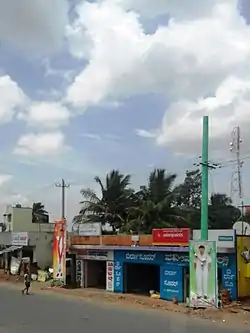
Kadakola
Kadakola is a Town and a suburb of Mysuru metropoltian area in the southern state of Karnataka, India.[1][2] It is located in the Mysore taluk of Mysore district. In November 2020, Kadakola was upgraded from a Gram Panchayat to a Town Panchayat and a gazetted notification was passed on November 26th 2020.[3] The notification combines Kadakola and Mandakalli villages coming under Kadakola GP, Badipalya, Gudumadanahalli, S. Uttanahalli and Hosahundi villages coming under Hosahundi GP, Marase and Madaragalli villages coming under Devalapura GP, K.M. Hundi, K.N. Hundi, Gejjagalli and Yeligehundi villages, covering a total area of 34.71 sq. kms.[3] The combined population of the newly formed town is 19,969.[4]
Kadakola | |
|---|---|
Town | |
 Kadakola Town | |
| Coordinates: 12°11′32″N 76°39′55″E | |
| Country | |
| State | Karnataka |
| District | Mysore |
| Talukas | Mysore |
| Government | |
| • Body | Town Panchayat |
| Area | |
| • Total | 34.71 km2 (13.40 sq mi) |
| Population (2011) | |
| • Total | 19,969 |
| • Density | 580/km2 (1,500/sq mi) |
| Languages | |
| • Official | Kannada |
| Time zone | UTC+5:30 (IST) |
| ISO 3166 code | IN-KA |
| Vehicle registration | KA |
| Nearest city | Mysore |
Demographics
The newly formed town had a population of 19,315. The population breakdown is given below. [4]
| Area Name | Population According to Census 2011 |
| Kadakola | 6436 |
| Mandakalli | 3490 |
| Marse | 622 |
| Badipalya | 4357 |
| Gudumadanahalli | 777 |
| Uttanahalli | 1325 |
| Hosahundi | 2157 |
| Madaragalli | 151 |
Schools
- S.G.V.K. Convent School
- Government Primary school
- BKT public school
Post office
There is a post office at Kadakola and the pincode is 571311.[5]
Transportation
There is a small railway station at Kadakola where only slow trains to Mysore and Chamarajanagar stop. This railway station is part of Mysore-Chamarajanagar branch line. Buses are available to Mysore city which is 14.7 km away. The nearest airport is Mysuru airport at mandakalli which is 8 km away. The railway station also serves as a logistics hotspot with Inland Container Depot being built.[6] Mysuru Airport is located in Mandakalli of Kadakola Town Panchayat.
Villages and suburbs
Thandavapura (3 km), Sinduvalli (3 km), Someshwarapura (4 km), Devalapura (6 km), Hosahundi (7 km) are the nearby villages. Other nearby villages are Kongara, Nanjaianahundi, Beeregowdana hundi and Kardimarayana hundi.
Image gallery
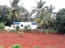
 Yenne river, Kadakola
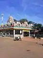
 Kadakola temple
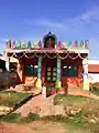 Small Devastahana
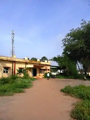 Kadakola Railway Station
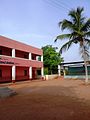


References
- Village code= 2825300 "Census of India : Villages with population 5000 & above". Registrar General & Census Commissioner, India. Archived from the original on 11 February 2008. Retrieved 18 December 2008.
- "Yahoomaps India :". Archived from the original on 18 December 2008. Retrieved 18 December 2008. Kadakola, Mysore, Karnataka
- "Hootagalli CMC and four Town Panchayats formed: Govt. issues Gazette notification". Star of Mysore. 26 November 2020. Retrieved 6 December 2020.
- "Census 2011 Handbook Mysore" (PDF).
- http://www.mapsofindia.com/pincode/india/karnataka/mysore/kadakola.html
- "Concor Project begins amidst tight security". Star of Mysore. 17 October 2019. Retrieved 6 December 2020.
External links
- "Mysuru District Information". Mysore.nic.in. Retrieved 1 May 2016.