Kalmar County
Kalmar County (Swedish: Kalmar län) is a county or län in southern Sweden. It borders the counties of Kronoberg, Jönköping, Blekinge and Östergötland. To the east in the Baltic Sea is the island Gotland.
Kalmar County
Kalmar län | |
|---|---|
 Flag  Coat of arms | |
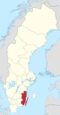 Kalmar County in Sweden | |
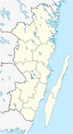 Location map of Kalmar County in Sweden | |
| Coordinates: 56°44′0″N 15°54′0″E | |
| Country | Sweden |
| Founded | 1634 |
| Capital | Kalmar |
| Municipalities | |
| Government | |
| • Governor | Thomas Carlzon |
| • County Council | Landstinget i Kalmar län |
| Area | |
| • Total | 11,217.8 km2 (4,331.2 sq mi) |
| Population (30 September 2017)[1] | |
| • Total | 243,219 |
| • Density | 22/km2 (56/sq mi) |
| Time zone | UTC+1 (CET) |
| • Summer (DST) | UTC+2 (CEST) |
| ISO 3166 code | SE-H |
| GDP/ Nominal | SEK million (2004) |
| GDP per capita | SEK |
| NUTS Region | SE213 |
| Website | www |
The counties are mainly administrative units. Geographically Kalmar County covers the eastern part in the Småland province, and the entire island of Öland.
Culture
Much of Öland's present day landscape known as the Stora Alvaret has been designated as a World Heritage Site by UNESCO. This southern part of Öland is known for a large number of rare species; early paleolithic settlement at Alby; other prehistoric remains such as the Gettlinge Gravefield and Eketorp Fortress; and the Ottenby Nature Preserve.
Administration
Kalmar County was integrated with Kronoberg County until 1672. Blekinge was a part of Kalmar County between 1680 and 1683, due to the foundation of the naval base at Karlskrona.
The seat of residence for the Governor or Landshövding is Kalmar. The Governor is the head of the County Administrative Board or Länsstyrelse. The County Administrative Board is a Government Agency headed by a Governor. The current Governor is Stefan Carlsson. See List of Kalmar County Governors.
Since 1997 The municipalities and the county council cooperate through the indirectly politically controlled Regional Council of Kalmar County. The regional council represents the municipalities interests in regional growth issues, coordinates infrastructure planning, higher education, common cultural issues and administers various governmental an EU grants.
Governors
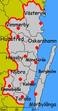
Localities in order of size
The five most populous localities of Kalmar County in 2018:[2]
| # | Locality | Population |
|---|---|---|
| 1 | Kalmar | 40,434 |
| 2 | Västervik | 21,452 |
| 3 | Oskarshamn | 18,541 |
| 4 | Nybro | 13,494 |
| 5 | Vimmerby | 8,298 |
Foreign background
SCB have collected statistics on backgrounds of residents since 2002. These tables consist of all who have two foreign-born parents or are born abroad themselves.[3] The chart lists election years and the last year on record alone.
| Location | 2002 | 2006 | 2010 | 2014 | 2018 | 2019 |
|---|---|---|---|---|---|---|
| Borgholm | 5.3 | 5.7 | 7.2 | 9.1 | 12.3 | 12.4 |
| Emmaboda | 10.2 | 11.9 | 13.6 | 15.8 | 22.3 | 23.4 |
| Hultsfred | 9.3 | 10.6 | 13.2 | 17.6 | 24.6 | 24.7 |
| Högsby | 10.3 | 11.4 | 14.8 | 19.2 | 28.7 | 28.5 |
| Kalmar | 8.9 | 10.3 | 12.1 | 13.9 | 17.1 | 17.9 |
| Mönsterås | 6.8 | 8.4 | 9.1 | 12.3 | 17.1 | 17.3 |
| Mörbylånga | 4.6 | 4.8 | 5.8 | 7.1 | 9.8 | 9.9 |
| Nybro | 9.7 | 10.6 | 12.5 | 15.9 | 21.8 | 22.1 |
| Oskarshamn | 8.8 | 10.2 | 11.9 | 14.1 | 17.9 | 18.3 |
| Torsås | 5.4 | 6.9 | 8.6 | 9.8 | 13.5 | 13.4 |
| Vimmerby | 5.8 | 7.2 | 8.8 | 10.5 | 15.3 | 15.5 |
| Västervik | 7.2 | 8.0 | 9.0 | 10.8 | 13.9 | 14.0 |
| Total | 8.0 | 9.1 | 10.7 | 13.0 | 17.2 | 17.5 |
| Source: SCB [3] | ||||||
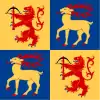
Heraldry
The County of Kalmar was formally granted its arms in 1944. Before this the county carried the arms of Småland and Öland side by side. The current arms is a combination of the arms for Småland and Öland. Blazon: "Quartered, the arms of Småland and Öland"
See also
References and notes
- "Folkmängd i riket, län och kommuner 30 september 2017 och befolkningsförändringar 1 juli–30 september 2017. Totalt". Statistics Sweden. 8 November 2017. Retrieved 19 November 2017.
- "Localities 2018 – population, land area, population density" (XLSX). Statistics Sweden. 24 October 2019. Retrieved 24 November 2019.
- "PxWeb - välj variabler och värden" (in Swedish). SCB. Retrieved 11 August 2020.
External links
- Kalmar County Administrative Board
- The Regional Council of Kalmar County
- Kalmar County Council
- University of Kalmar
- Hotels in Kalmar
Municipalities and seats of Kalmar County | ||
|---|---|---|
| Municipalities | ||
| Municipal seats | ||
| Authority control |
|---|
