Kamarang
Kamarang is an Amerindian village,[2] standing at the confluence of the Kamarang River and Mazaruni River, in the Cuyuni-Mazaruni Region of Guyana.
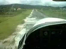
Approach of Kamarang airstrip.Taken from cockpit of Cessna 208 Caravan
Kamarang | |
|---|---|
Village | |
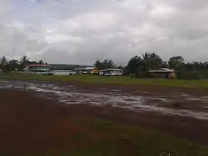 Kamarang looking east | |
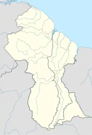 Kamarang Location in Guyana | |
| Coordinates: 5°51′55″N 60°36′51″W | |
| Country | |
| Region | Cuyuni-Mazaruni |
| Government | |
| • Type | Village-Council |
| Population (2012)[1] | |
| • Total | 347 |
Kamarang has a Primary School,[3] Hospital,[4] Police station[5] and can be accessed by air via the Kamarang Airport.[6]
The village has seen extensive economic growth at the start of the 21st century because of gold and diamond mining, however as of 2019, the output has started to decline.[7] Its altitude is 490 metres (1601 feet).
References
- "2012 Population by Village". Statistics Guyana. Retrieved 16 August 2020.
- "Indigenous village". Ministry of Indigenous Peoples’ Affairs. Retrieved 18 August 2020.
- "$30M primary school for Kamarang". Department of Public Information. Retrieved 17 August 2020.
- "New Doctors' Quarters, extension of District Hospital for Kamarang". Department of Public Information. Retrieved 17 August 2020.
- "Contact numbers for key personnel in all policing divisions". Stabroek News. Retrieved 17 August 2020.
- "Kamarang Airport". Sky Brary. Retrieved 17 August 2020.
- "Mined-out areas cool Kamarang's once raging gold fever". Stabroek News. Retrieved 17 August 2020.
| Wikimedia Commons has media related to Kamarang. |
This article is issued from Wikipedia. The text is licensed under Creative Commons - Attribution - Sharealike. Additional terms may apply for the media files.