Kamayagoundanpatti
Kamayagoundanpatti is a panchayat town in Theni district in the Indian state of Tamil Nadu.
Kamayagoundanpatti | |
|---|---|
Major Panchayat | |
| Nickname(s): கே.கே.பட்டி | |
 Kamayagoundanpatti Location in Tamil Nadu, India  Kamayagoundanpatti Kamayagoundanpatti (India) | |
| Coordinates: 9°43′34″N 77°19′07″E | |
| Country | |
| State | தமிழ் நாடு |
| District | Theni |
| Population (2011) | |
| • Total | 16,134 |
| Tamil,Kannada, Telugu | |
| • Official | Tamil |
| Time zone | UTC+5:30 (IST) |
| Vehicle registration | TN 60 |
Demographics
As of 2001 India census,[1] Kamayagoundanpatti is a beautiful village in cumbum valley located near the bank of the river mullaiperiyar. It is an agricultural village had a population of 12,165. Males constitute 48% of the population and females 52%. Kamayagoundanpatti has an average literacy rate of 61%, higher than the national average of 59.5%: male literacy is 69%, and female literacy is 54%. In Kamayagoundanpatti, 11% of the population is under 6 years of age.there are lot of caste available in this village. Located in State Highways, 6 km south of Uthamapalayam and 4 km east of Cumbum, surrounded by Megamalai in the east and by western ghats of Suruli Hills in the south and Cumbum mettu hills in the west.
References
- "Census of India 2001: Data from the 2001 Census, including cities, villages and towns (Provisional)". Census Commission of India. Archived from the original on 16 June 2004. Retrieved 1 November 2008.
| Taluks | 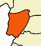 | |
|---|---|---|
| Revenue blocks | ||
| Cities and towns |
| |
| Villages | ||
| Places of interest | ||