Kanchanadit District
Kanchanadit (Thai: กาญจนดิษฐ์, pronounced [kāːn.t͡ɕā.ná.dit]) is a district (amphoe) in Surat Thani Province, south Thailand.
Kanchanadit
กาญจนดิษฐ์ | |
|---|---|
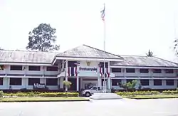 Kanchanadit District office | |
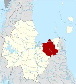 District location in Surat Thani Province | |
| Coordinates: 9°09′56″N 99°28′16″E | |
| Country | Thailand |
| Province | Surat Thani |
| Seat | Kadae |
| Area | |
| • Total | 879.0 km2 (339.4 sq mi) |
| Population (2014) | |
| • Total | 103,942 |
| • Density | 109.8/km2 (284/sq mi) |
| Time zone | UTC+7 (ICT) |
| Postal code | 84160 |
| Geocode | 8402 |
History
Originally the town was named Tha Thong (ท่าทอง) and was on the shore of Khlong Tha Thong Mai (named Khlong Tha Phet at that time). During the reign of King Nangklao (Rama III) the town was moved because it was malaria-infested, and renamed Kanchanadit. It was a provincial town (mueang) under the control of Nakhon Si Thammarat. During the reign of Rama IV it was put under the supervision of Bangkok directly. In 1899 the province was merged with Chaiya and was thus reduced to amphoe (district) status.[1]
Geography
The district is in the eastern part of the province. It stretches from the coast to Bandon Bay of the Gulf of Thailand in the north, the low river valley of the Tapi River to the west, and the Nakhon Si Thammarat mountain range in the south and west. Tai Rom Yen National Park was created on 31 December 1991, protecting the forested hills of that mountain range. The main river in the district is the Thathong River, which empties into the Tapi estuary.
Neighboring districts are (from the east clockwise): Don Sak, Sichon, and Nopphitam of Nakhon Si Thammarat Province; Ban Na San and Mueang Surat Thani.
The main road through the district is Thailand Route 401, which connects Kanchanadit with the town of Surat Thani. Thailand Route 44 begins at Route 401 and runs to the southwest as part of a land bridge across the Malay Peninsula.
Administration
Central administration
.jpg.webp)

Kanchanadit District is divided into 13 sub-districts (tambons), which are further subdivided into 117 administrative villages (mubans).
| No. | Name | Thai | Villages | Pop.[2] |
|---|---|---|---|---|
| 1. | Tha Thong Mai | ท่าทองใหม่ | 5 | 11,500 |
| 2. | Tha Thong | ท่าทอง | 9 | 5,617 |
| 3. | Kadae | กะแดะ | 9 | 9,492 |
| 4. | Thung Kong | ทุ่งกง | 5 | 5,100 |
| 5. | Krut | กรูด | 10 | 9,695 |
| 6. | Chang Sai | ช้างซ้าย | 12 | 10,763 |
| 7. | Phlai Wat | พลายวาส | 9 | 6,826 |
| 8. | Pa Ron | ป่าร่อน | 9 | 7,647 |
| 9. | Takhian Thong | ตะเคียนทอง | 7 | 6,373 |
| 10. | Chang Khwa | ช้างขวา | 14 | 10,075 |
| 11. | Tha U-thae | ท่าอุแท | 13 | 10,442 |
| 12. | Thung Rang | ทุ่งรัง | 5 | 4,193 |
| 13. | Khlong Sa | คลองสระ | 10 | 6,219 |
Local administration
There are five sub-district municipalities (thesaban tambons) in the district:
- Kanchanadit (Thai: เทศบาลตำบลกาญจนดิษฐ์) consisting of sub-district Kadae.
- Tha Thong Mai (Thai: เทศบาลตำบลท่าทองใหม่) consisting of parts of sub-district Tha Thong Mai.
- Chang Sai (Thai: เทศบาลตำบลช้างซ้าย) consisting of sub-district Chang Sai.
- Krut (Thai: เทศบาลตำบลกรูด) consisting of sub-district Krut.
- Chang Khwa (Thai: เทศบาลตำบลช้างขวา) consisting of sub-district Chang Khwa.
There are nine sub-district administrative organizations (SAO) in the district:
- Tha Thong Mai (Thai: องค์การบริหารส่วนตำบลท่าทองใหม่) consisting of parts of sub-district Tha Thong Mai.
- Tha Thong (Thai: องค์การบริหารส่วนตำบลท่าทอง) consisting of sub-district Tha Thong.
- Thung Kong (Thai: องค์การบริหารส่วนตำบลทุ่งกง) consisting of sub-district Thung Kong.
- Phlai Wat (Thai: องค์การบริหารส่วนตำบลพลายวาส) consisting of sub-district Phlai Wat.
- Pa Ron (Thai: องค์การบริหารส่วนตำบลป่าร่อน) consisting of sub-district Pa Ron.
- Takhian Thong (Thai: องค์การบริหารส่วนตำบลตะเคียนทอง) consisting of sub-district Takhian Thong.
- Tha U-thae (Thai: องค์การบริหารส่วนตำบลท่าอุแท) consisting of sub-district Tha U-thae.
- Thung Rang (Thai: องค์การบริหารส่วนตำบลทุ่งรัง) consisting of sub-district Thung Rang.
- Khlong Sa (Thai: องค์การบริหารส่วนตำบลคลองสระ) consisting of sub-district Khlong Sa.
References
- "แจ้งความกระทรวงมหาดไทย" (PDF). Royal Gazette (in Thai). 16 (29): 428. 1899-10-15.
- "Population statistics 2014" (in Thai). Department of Provincial Administration. Retrieved 2015-06-23.
External links
- amphoe.com (Thai)