Kang La Pass
Kang La Pass or Kang La is a mountain pass in the Manang District of Gandaki Pradesh province of Nepal. Kang La Pass at the head of Miyar Valley is one of the extreme points of India.
| Kang La Pass | |
|---|---|
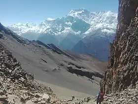 Kang La Pass. The route to Manang is to the north, and view of Annapurna Range from Kang la pass | |
| Elevation | 5,306 m (17,408 ft)[1] |
| Location | Nepal |
| Range | Himalayas |
References
- Annapurna; Tilicho & Naar-Phu (Map). 1:125,000. Cartography by Himalayan Maphouse Pvt Ltd. Nepa Maps. August 2009. § B5-B6. ISBN 99933-2-307-1.
This article is issued from Wikipedia. The text is licensed under Creative Commons - Attribution - Sharealike. Additional terms may apply for the media files.
