Kanuma, Tochigi
Kanuma (鹿沼市, Kanuma-shi) is a city located in Tochigi Prefecture, Japan. As of 1 August 2020, the city had an estimated population of 94,926 in 36,795 households,[1] and a population density of 190 persons per km². The total area of the town is 490.64 km2 (189.44 sq mi).
Kanuma
鹿沼市 | |
|---|---|
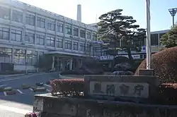 Kanuma City Hall | |
 Flag  Seal | |
 Location of Kanuma in Tochigi Prefecture | |
 Kanuma | |
| Coordinates: 36°34′1.5″N 139°44′42.2″E | |
| Country | Japan |
| Region | Kantō |
| Prefecture | Tochigi |
| Area | |
| • Total | 490.64 km2 (189.44 sq mi) |
| Population (August 2020) | |
| • Total | 94,926 |
| • Density | 190/km2 (500/sq mi) |
| Time zone | UTC+9 (Japan Standard Time) |
| - Tree | Cryptomeria |
| - Flower | Satsuki azalea |
| Phone number | 0289-64-2111 |
| Address | 1688-1 Imamiyachō, Kanuma-shi, Tochigi-ken 322-0068 |
| Website | Official website |

Geography
Kanuma is located in central Tochigi Prefecture. The cities is located in the northern part of the Kanto region. The western half of the city area is occupied by the Ashio Mountains, and the eastern half by a diluvial plateau called Kanuma Plateau. The city is bordered by the prefectural capital of Utsunomiya to the east.
Surrounding municipalities
Climate
Kanuma has a Humid continental climate (Köppen Cfa) characterized by warm summers and cold winters with heavy snowfall. The average annual temperature in Kanuma is 12.9 °C. The average annual rainfall is 1501 mm with September as the wettest month. The temperatures are highest on average in August, at around 25.3 °C, and lowest in January, at around 1.4 °C.[2]
| Climate data for Kanuma(1981-2010) | |||||||||||||
|---|---|---|---|---|---|---|---|---|---|---|---|---|---|
| Month | Jan | Feb | Mar | Apr | May | Jun | Jul | Aug | Sep | Oct | Nov | Dec | Year |
| Record high °C (°F) | 17.0 (62.6) |
21.2 (70.2) |
26.2 (79.2) |
29.5 (85.1) |
34.0 (93.2) |
37.0 (98.6) |
36.3 (97.3) |
36.5 (97.7) |
35.6 (96.1) |
31.4 (88.5) |
24.0 (75.2) |
23.2 (73.8) |
37.0 (98.6) |
| Average high °C (°F) | 7.7 (45.9) |
8.4 (47.1) |
11.8 (53.2) |
17.7 (63.9) |
21.8 (71.2) |
24.5 (76.1) |
27.9 (82.2) |
29.6 (85.3) |
25.7 (78.3) |
20.5 (68.9) |
15.2 (59.4) |
10.4 (50.7) |
18.4 (65.1) |
| Daily mean °C (°F) | 1.3 (34.3) |
2.0 (35.6) |
5.5 (41.9) |
11.3 (52.3) |
16.2 (61.2) |
19.8 (67.6) |
23.2 (73.8) |
24.5 (76.1) |
20.7 (69.3) |
14.9 (58.8) |
8.8 (47.8) |
3.6 (38.5) |
12.6 (54.7) |
| Average low °C (°F) | −3.9 (25.0) |
−3.3 (26.1) |
−0.3 (31.5) |
5.2 (41.4) |
11.1 (52.0) |
15.8 (60.4) |
19.6 (67.3) |
20.8 (69.4) |
17.0 (62.6) |
10.4 (50.7) |
3.8 (38.8) |
−1.4 (29.5) |
7.9 (46.2) |
| Record low °C (°F) | −10.9 (12.4) |
−11.3 (11.7) |
−9.3 (15.3) |
−4.7 (23.5) |
1.0 (33.8) |
7.8 (46.0) |
11.4 (52.5) |
12.2 (54.0) |
5.5 (41.9) |
0.1 (32.2) |
−4.3 (24.3) |
−9.1 (15.6) |
−11.3 (11.7) |
| Average precipitation mm (inches) | 36.8 (1.45) |
43.7 (1.72) |
91.1 (3.59) |
129.2 (5.09) |
151.2 (5.95) |
190.6 (7.50) |
227.7 (8.96) |
249.7 (9.83) |
234.9 (9.25) |
154.9 (6.10) |
75.6 (2.98) |
33.6 (1.32) |
1,618.8 (63.73) |
| Average precipitation days (≥ 1.0 mm) | 4.0 | 5.4 | 9.5 | 11.0 | 12.5 | 14.9 | 16.3 | 13.4 | 13.9 | 10.1 | 6.8 | 3.5 | 121.2 |
| Mean monthly sunshine hours | 194.5 | 180.6 | 183.3 | 179.8 | 163.1 | 113.2 | 115.4 | 141.0 | 116.3 | 140.0 | 162.4 | 189.0 | 1,877.8 |
| Source 1: 理科年表 | |||||||||||||
| Source 2: Japan Meteorological Agency (averages:1981-2010、peaks:1888-present)[3][4] | |||||||||||||
Demographics
Per Japanese census data,[5] the population of Kanuma has remained relatively steadily over the past 30 years.
| Year | Pop. | ±% |
|---|---|---|
| 1920 | 68,981 | — |
| 1930 | 74,561 | +8.1% |
| 1940 | 77,462 | +3.9% |
| 1950 | 98,504 | +27.2% |
| 1960 | 91,896 | −6.7% |
| 1970 | 89,196 | −2.9% |
| 1980 | 95,999 | +7.6% |
| 1990 | 101,098 | +5.3% |
| 2000 | 104,764 | +3.6% |
| 2010 | 103,257 | −1.4% |
History
Kanuma was the castle town for a 25,000 koku feudal domain in the early Edo period. Even after the domain was suppressed by the Tokugawa shogunate, the area continued to prosper from its location with a number of post stations on the Nikkō Reiheishi Kaidō. The town of Kanuma was created on April 1, 1889 with the establishment of then modern municipalities system. It was raised to city status on October 10, 1948. On January 1, 2006, the town of Awano (from Kamitsuga District) was merged into Kanuma.
Government
Kanuma has a mayor-council form of government with a directly elected mayor and a unicameral city legislature of 24 members. Kanuma contributes three members to the Tochigi Prefectural Assembly. In terms of national politics, the city is part of Tochigi 2nd district of the lower house of the Diet of Japan.
Economy
The economy of Kanuma is primarily agricultural. Hemp was once a major cash crop, but has been supplanted by soba and strawberries.
Education
Kanuma has 24 primary schools and ten middle schools operated by the city government. The city has four public high schools operated by the Tochigi Prefectural Board of Education.[6]
Transportation
Highway
.png.webp) Tōhoku Expressway – Kanuma Interchange
Tōhoku Expressway – Kanuma Interchange National Route 121
 National Route 293
 National Route 352
External relations
 – Tieling, Liaoning, China
 – Grand Forks, North Dakota, USA [7]
Noted people
- Guts Ishimatsu, boxer
- Hisae Watanabe, mixed martial arts fighter
- Hisashi Kurosaki, football player
- Manabu Wakabayashi, football player
- Sayaka Hirano, table tennis player
- Takeji Nara, Imperial Japanese Army general
- Tosio Kato, mathematician
- Michio Yuzawa, politician and cabinet minister
References
- "Kanuma City official statistics" (in Japanese). Japan.
- Kanuma climate data
- "平年値(年ごとの値)". Japan Meteorological Agency. Retrieved 2012-08-10.
- "観測史上1~10位の値(年間を通じての値)". Japan Meteorological Agency. Retrieved 2012-08-10.
- Kanuma population statistics
- "Elementary and junior high schools". Kanuma City. 3 April 2019. Retrieved 25 January 2020.
- Bakken, Ryan (2003-10-21). "Japanese Residents Will Dedicate New Garden". Grand Forks Herald.
External links
![]() Media related to Kanuma, Tochigi at Wikimedia Commons
Media related to Kanuma, Tochigi at Wikimedia Commons
- Official Website (in Japanese)
| Core city | Flag of Tochigi Prefecture | |
|---|---|---|
| Cities | ||
| Districts | ||
| Authority control |
|---|