Karasuwa
Karasuwa is a Local Government Area in Yobe State, Nigeria. Its headquarters are in the town of Jajimaji on the Hadejia River at 12°53′57″N 10°48′28″E.
Karasuwa | |
|---|---|
LGA | |
 Karasuwa Location in Nigeria | |
| Coordinates: 13°00′N 10°47′E | |
| Country | |
| State | Yobe State |
| Area | |
| • Total | 1,162 km2 (449 sq mi) |
| Population (2006 census) | |
| • Total | 106,992 |
| Time zone | UTC+1 (WAT) |
| 3-digit postal code prefix | 630 |
| ISO 3166 code | NG.YO.KA |
It has an area of 1,162 km2 and a population of 106,992 at the 2006 census.
Land Areas
Karasuwa local government area consists of larger towns which include: Jajimaji, Bukarti, Kasuwa Sidi, and small villages such as Tsamiyan Gada, etc.
The postal code of the area is 630.[1]
Cultures and Tribes
Basically the people predominantly live in Karasuwa, which is 70 percent Manga tribe, which originated from sub Kanuri tribe. Most residents are farmers, both in towns and villages.
The Bade language is spoken in Karasuwa LGA.[2]
References
- "Post Offices- with map of LGA". NIPOST. Archived from the original on 2009-10-07. Retrieved 2009-10-20.
- "Bade". Ethnologue. Retrieved 2014-05-25.
State capital: Damaturu | ||
| Local Government Areas | 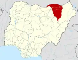 | |
This article is issued from Wikipedia. The text is licensed under Creative Commons - Attribution - Sharealike. Additional terms may apply for the media files.
