Fika, Nigeria
Fika is a Local Government Area in Yobe State, Nigeria. Its headquarters are in the town of Fika in the south of the area at11°17′00″N 11°18′29″E.
Fika | |
|---|---|
LGA and town | |
 Fika Location in Nigeria | |
| Coordinates: 11°25′N 11°13′E | |
| Country | |
| State | Yobe State |
| Area | |
| • Total | 2,208 km2 (853 sq mi) |
| Population (2006 census) | |
| • Total | 136,895 |
| Time zone | UTC+1 (WAT) |
| 3-digit postal code prefix | 622 |
| ISO 3166 code | NG.YO.FI |
It has an area of 2,208 km2 and a population of 136,895 at the 2006 census.
The postal code of the area is 622.[1]
Geography
The northeasterly line of equal latitude and longitude passes through the area close to Fika.
Ngalda Is the largest town in the Fika LGA. It Is Located At The Border To Gombe State, About 85km From Potiskum.[2]
Gadaka is Also the largest town in the Fika LGA. It is located at about 12 km off the Potiskum-Gombe main road, about 55 km from the commercial city of Potiskum.[3]
References
- "Post Offices- with map of LGA". NIPOST. Archived from the original on November 26, 2012. Retrieved 2009-10-20.
- ZAKAR BZ NGALDA, adamu. "MR". BZ. Missing or empty
|url=(help) - BABI, Mohammed Saleh. "MR". MNIM. Missing or empty
|url=(help)
State capital: Damaturu | ||
| Local Government Areas | 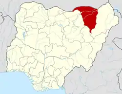 | |
This article is issued from Wikipedia. The text is licensed under Creative Commons - Attribution - Sharealike. Additional terms may apply for the media files.