Karaurín-tepui
Karaurín-tepui, also spelled Caraurín, is a tepui of the Eastern Tepuis chain in Bolívar state, Venezuela.[1] It has a maximum elevation of around 2,500 metres (8,200 ft) above sea level. The summit plateau is covered by shrubby vegetation and has an area of 1.88 km2 (0.73 sq mi).[1] The foothills of the tepui are covered in forests. Karaurín-tepui lies just south of the much larger Ilú–Tramen Massif.[1]
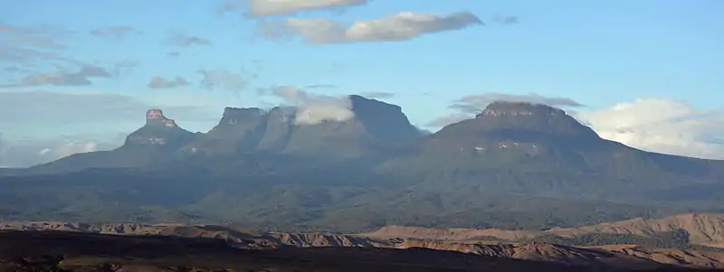
Western side of the Ilú–Tramen Massif (left and centre) and Karaurín-tepui (right) as seen from the Gran Sabana
| Karaurín-tepui | |
|---|---|
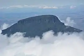 Eastern face of Karaurín as seen from a helicopter | |
| Highest point | |
| Elevation | 2,500 m (8,200 ft) [1] |
| Coordinates | 05°21′28″N 61°00′18″W |
| Geography | |
.jpg.webp) Karaurín-tepui Location in Venezuela | |
| Location | Bolívar, Venezuela |
See also
References
- Huber, O. (1995). Geographical and physical features. In: P.E. Berry, B.K. Holst & K. Yatskievych (eds.) Flora of the Venezuelan Guayana. Volume 1. Introduction. Missouri Botanical Garden Press, St. Louis. pp. 1–61.
This article is issued from Wikipedia. The text is licensed under Creative Commons - Attribution - Sharealike. Additional terms may apply for the media files.