Karim Lamido
Karim Lamido is a Local Government Area in Taraba State, Nigeria. Its headquarters are in the town of Karim Lamido at 9°18′00″N 11°12′00″E.
Karim Lamido | |
|---|---|
LGA and town | |
 Karim Lamido Location in Nigeria | |
| Coordinates: 9°12′N 10°53′E | |
| Country | |
| State | Taraba State |
| Local Government Headquarters | Karim Lamido |
| Government | |
| • Local Government Chairman and the Head of the Local Government Council | Idi Malli Danfulani[1] |
| Area | |
| • Total | 6,620 km2 (2,560 sq mi) |
| Population (2006 census) | |
| • Total | 195,844 |
| Time zone | UTC+1 (WAT) |
| 3-digit postal code prefix | 662 |
| ISO 3166 code | NG.TA.KL |
It has an area of 6,620 km2 and a population of 195,844 at the 2006 census.
The southern border of Karin Lamido is the Benue River and it is traversed by several tributaries of that river.
The postal code of the area is 662.[2]
Karim Lamido has various ethnic groups, including Jenjo, Wurkum, Karinjo Bambuka, Munga, Dadiya and Hausa Fulani. It contains about 11 political wards, some of which are Jen Ardido, Jen Kaigama, Muri A, Muri B, Muri C, etc.
See also
References
- "Taraba State Local Government Council Chairmen". Nigeria: Taraba State. Retrieved 11 February 2020.
- "Post Offices- with map of LGA". NIPOST. Archived from the original on 7 October 2009. Retrieved 20 October 2009.
State capital: Jalingo | ||
| Local Government Areas | 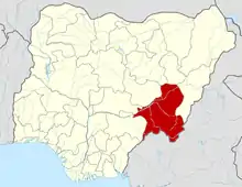 | |
This article is issued from Wikipedia. The text is licensed under Creative Commons - Attribution - Sharealike. Additional terms may apply for the media files.
