Wukari
Wukari is a Local Government Area in Taraba State, Nigeria. Its headquarters is in the town of Wukari on the A4 highway. The Donga River flows through the area and the Benue River forms a boundary with Nasarawa State to the northwest. It has an area of 4,308 km2 and a population of 241,546 at the 2006 census. The postal code of the area is 670.[2]
Wukari
Ukari Waka | |
|---|---|
LGA and Town | |
| Nickname(s): Croc Town | |
 Wukari Location in Nigeria | |
| Coordinates: 7°51′N 9°47′E | |
| Country | |
| State | Taraba State |
| LGA | Wukari |
| Government | |
| • Type | Democracy |
| • Chairman and the Head of the Local Government Council | Adi Daniel[1] |
| Area | |
| • Total | 4,308 km2 (1,663 sq mi) |
| Population (2006 census) | |
| • Total | 241,546 |
| Time zone | UTC+1 (WAT) |
| 3-digit postal code prefix | 670 |
| ISO 3166 code | NG.TA.WU |
| Climate | Aw |
Wukari town
The town is the base of the Wukari Federation, a traditional state. It is the home to Jukun and Tiv peoples, two major ethnic group in West Africa. The local languages are Jukun (Wapan, Jibu, Nyifon) and Tiv.[3]
Education
Tertiary education
The town has tertiary institutions such as:
- Kwararafa University[4]
- Federal University Wukari
- Wukari Jubilee University
List of secondary schools in Wukari LGA
- Adigrace College, Byepyi
- Government Day Secondary School
- Mater Dei Nursery and Primary School
Excel model secondary school Federal government college
References
- admin. "Local Govt. Chairmen". TARABA STATE GOVERNMENT. Retrieved 18 August 2020.
- "Post Offices- with map of LGA". NIPOST. Retrieved 20 October 2009.
- Blench, Roger (2019). An Atlas of Nigerian Languages (4th ed.). Cambridge: Kay Williamson Educational Foundation.
- "Private Universities". National Universities Commission. Retrieved 30 December 2018.
State capital: Jalingo | ||
| Local Government Areas | 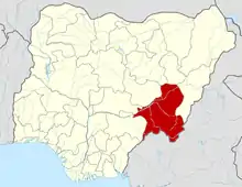 | |
This article is issued from Wikipedia. The text is licensed under Creative Commons - Attribution - Sharealike. Additional terms may apply for the media files.