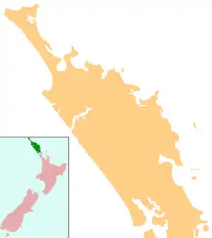
Kauri, New Zealand
Kauri is a locality in Northland, New Zealand. State Highway 1 passes through the area. Kamo is to the south, and Hikurangi is to the north.[1][2] Mt Parakiore is a volcanic dome rising 391 metres (1,283 ft) to the southwest. It is about one million years old, and part of the Harbour Fault, which also includes Mt Hikurangi near Hikurangi, and Parahaki in Whangarei.[3]
Kauri | |
|---|---|
 Kauri | |
| Coordinates: 35°38′47″S 174°17′44″E | |
| Country | New Zealand |
| Region | Northland Region |
| District | Whangarei District |
The area, initially called Kaurihohore, was settled by immigrants from Nova Scotia in 1856.[4][5]
Demographics
| Year | Pop. | ±% p.a. |
|---|---|---|
| 2006 | 1,338 | — |
| 2013 | 1,488 | +1.53% |
| 2018 | 1,746 | +3.25% |
| Source: [6] | ||
.jpg.webp)
The statistical area of Kauri, which at 56 square kilometres is larger than this locality, had a population of 1,746 at the 2018 New Zealand census, an increase of 258 people (17.3%) since the 2013 census, and an increase of 408 people (30.5%) since the 2006 census. There were 588 households. There were 879 males and 867 females, giving a sex ratio of 1.01 males per female. Of the total population, 363 people (20.8%) were aged up to 15 years, 219 (12.5%) were 15 to 29, 846 (48.5%) were 30 to 64, and 321 (18.4%) were 65 or older. Figures may not add up to the total due to rounding.
Ethnicities were 91.8% European/Pākehā, 17.2% Māori, 2.1% Pacific peoples, 1.9% Asian, and 1.9% other ethnicities. People may identify with more than one ethnicity.
The percentage of people born overseas was 15.8, compared with 27.1% nationally.
Although some people objected to giving their religion, 58.6% had no religion, 29.6% were Christian, and 2.9% had other religions.
Of those at least 15 years old, 252 (18.2%) people had a bachelor or higher degree, and 243 (17.6%) people had no formal qualifications. The median income was $36,000. The employment status of those at least 15 was that 705 (51.0%) people were employed full-time, 222 (16.1%) were part-time, and 48 (3.5%) were unemployed.[6]
Education
Kaurihohore School is a coeducational contributing primary school (years 1-6) school with a decile rating of 7[7] and a roll of 193[8] (March 2020). The school celebrated its 125th jubilee in 2002.[9]
Notes
- Peter Dowling (editor) (2004). Reed New Zealand Atlas. Reed Books. Map 5. ISBN 0-7900-0952-8.CS1 maint: extra text: authors list (link)
- Roger Smith, GeographX (2005). The Geographic Atlas of New Zealand. Robbie Burton. Map 24. ISBN 1-877333-20-4.
- Bruce Hayward; Mike Isaac; Keith Miller; Bernhard Spörli (2002). "Introduction to Whangarei geology" (PDF). Geological Society of New Zealand. p. 27. Archived from the original (PDF) on 4 March 2009.
- Pickmere, Nancy Preece (1986). Whangarei: The Founding Years. pp. 76, 102.
- Centennial Committee, Kaurihohore (1957). The Story of Kaurihohore, 1856-1956.
- "Statistical area 1 dataset for 2018 Census". Statistics New Zealand. March 2020. Kauri (105300). 2018 Census place summary: Kauri
- Education Counts: Te Kete Ipurnphaka - Kaurihohore School
- "New Zealand Schools Directory". New Zealand Ministry of Education. Retrieved 26 April 2020.
- "Kaurihohore School 125th Jubilee". Education Gazette New Zealand. 81 (4). 11 March 2002.
