Kediet ej Jill
Kediet ej Jill is a mountain in Tiris Zemmour, Mauritania, with the city of Zouérat on its east and Fderick at west. At 915 m (3,002 ft) tall, Kediet ej Jill includes the highest peak in Mauritania.
| Kediet ej Jill | |
|---|---|
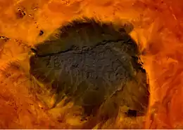 Mt. Kediet ej Jill, Mauritania - seen from space | |
| Highest point | |
| Elevation | 915 m (3,002 ft) |
| Prominence | 596 m (1,955 ft) |
| Listing | Country high point |
| Coordinates | 22°39′04″N 12°34′27″W |
| Geography | |
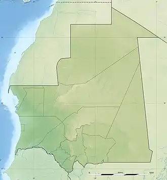 Kediet ej Jill Location of Kediet ej Jill in Mauritania | |
| Location | Mauritania |
The mountain and its surrounding area are rich in iron deposits, thought to have been mined here since the 11th century and commercially exploited since 1952. The current mines are connected to Nouadhibou on the Atlantic coast by a 700-km long railway.[1]
The mountain appears bluish because of the high concentration of magnetite, an iron ore and a natural magnet.[2] Owing to its inherent magnetic properties, the mountain disrupts navigational compasses. Similar magnetic fields allowed the discovery of other deposits in the region (magnetite guelbs) in the 1960s.
References
- SNIM, Mauritania, www.mining-technology.com (access: January 25 2017)
- European Space Agency, esa.int (access: August 2 2020)
External links
- Kediet ej Jill, Tiris Zemmour, Mauritania
- "Kdeyyat ej Joul, Mauritania". Peakbagger.com.
