Kentucky Route 166
Kentucky Route 166 (KY 166) is a 13.279-mile (21.370 km) state highway in Fulton County, Kentucky. It runs from Kentucky Route 125 southeast of Hickman to U.S. Route 45 and Kentucky Route 1648 in northwestern Fulton.
| ||||
|---|---|---|---|---|
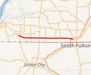
KY 166 highlighted in red | ||||
| Route information | ||||
| Maintained by KYTC | ||||
| Length | 13.279 mi[1] (21.370 km) | |||
| Major junctions | ||||
| West end | ||||
| East end | ||||
| Location | ||||
| Counties | Fulton | |||
| Highway system | ||||
| ||||

Major intersections
The entire route is in Fulton County.
| Location | mi[1] | km | Destinations | Notes | |
|---|---|---|---|---|---|
| | 0.000 | 0.000 | Western terminus | ||
| | 0.398 | 0.641 | |||
| | 1.015 | 1.633 | Western terminus of KY 116 | ||
| | 3.039 | 4.891 | |||
| | 5.106 | 8.217 | |||
| | 6.645 | 10.694 | |||
| | 8.978 | 14.449 | Southern terminus of KY 1125 | ||
| | 10.198 | 16.412 | Southern terminus of KY 1706 | ||
| | 11.230 | 18.073 | Southern terminus of KY 1909 | ||
| Fulton | 12.735 | 20.495 | |||
| 12.800 | 20.600 | ||||
| 13.070 | 21.034 | Northern terminus of KY 1644 | |||
| 13.219 | 21.274 | West end of KY 1648 overlap | |||
| 13.279 | 21.370 | Eastern terminus; east end of KY 1648 overlap; continues as KY 1648 beyond US 45 | |||
1.000 mi = 1.609 km; 1.000 km = 0.621 mi
| |||||
This article is issued from Wikipedia. The text is licensed under Creative Commons - Attribution - Sharealike. Additional terms may apply for the media files.