Kentucky Route 54
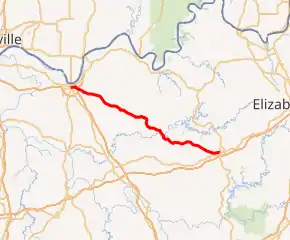
Kentucky Route 54 (KY 54) is a 54.329-mile-long (87.434 km) state highway in the U.S. state of Kentucky.
| ||||
|---|---|---|---|---|

KY 54 highlighted in red | ||||
| Route information | ||||
| Maintained by KYTC | ||||
| Length | 54.329 mi[1] (87.434 km) | |||
| Major junctions | ||||
| West end | ||||
| East end | ||||
| Location | ||||
| Counties | Daviess, Ohio, Grayson | |||
| Highway system | ||||
| ||||
The highway, which begins at the intersection of Frederica Street and Parrish Avenue in Owensboro at its junction with Kentucky Route 81 and Kentucky Route 2831 (formerly US 431), connects Owensboro to Leitchfield, while also serving the smaller communities of Philpot, Whitesville and Fordsville.
In Owensboro proper, the route has over the years been straightened and widened, particularly toward the eastern reaches of the city. From Leitchfield Road to Kentucky Route 1456 (also known as Thruston-Dermont Road and Millers Mill Road), the highway is five lanes wide and serves as the backbone of the growing retail and service area which has grown up in the area surrounding the highway's interchange with US 60 and US 231.
Major intersections
| County | Location | mi[1] | km | Destinations | Notes |
|---|---|---|---|---|---|
| Daviess | Owensboro | 0.000 | 0.000 | Eastern terminus; northern terminus of KY 81 | |
| 0.260 | 0.418 | Southern terminus of KY 2262 | |||
| 0.514 | 0.827 | ||||
| 0.776 | 1.249 | ||||
| 2.566 | 4.130 | US 60 exit 18 | |||
| 3.318 | 5.340 | Northern terminus of KY 3143 | |||
| Dermont | 4.505 | 7.250 | |||
| | 6.447 | 10.375 | West end of KY 142 overlap | ||
| Philpot | 7.492 | 12.057 | East end of KY 142 overlap | ||
| Whitesville | 15.172 | 24.417 | West end of KY 764 overlap | ||
| 15.244 | 24.533 | East end of KY 764 overlap | |||
| Ohio | | 20.230 | 32.557 | Northern terminus of KY 1414 | |
| | 21.608 | 34.775 | Northern terminus of KY 2671 | ||
| | 23.637 | 38.040 | West end of KY 69 overlap | ||
| Fordsville | 24.666 | 39.696 | Southern terminus of KY 1700 | ||
| 25.027 | 40.277 | East end of KY 69 overlap | |||
| Ellmitch | 26.177 | 42.128 | Southern terminus of KY 261 | ||
| | 26.440 | 42.551 | Southern terminus of KY 629 | ||
| | 30.127 | 48.485 | Northern terminus of KY 919 | ||
| Shreve | 32.559 | 52.399 | Western terminus of KY 110 | ||
| Grayson | | 36.502 | 58.744 | Eastern terminus of KY 878 | |
| | 37.054 | 59.633 | West end of KY 736 overlap | ||
| | 37.386 | 60.167 | East end of KY 736 overlap | ||
| Short Creek | 43.484 | 69.981 | |||
| | |||||
| | |||||
| | 48.706 | 78.385 | Eastern terminus of KY 2804 | ||
| | 50.679 | 81.560 | Northern terminus of KY 2193 | ||
| | 51.398 | 82.717 | Northern terminus of KY 2777 | ||
| Leitchfield | 54.329 | 87.434 | traffic circle (Public Square) around Grayson County Courthouse | ||
1.000 mi = 1.609 km; 1.000 km = 0.621 mi
| |||||
References
- Division of Planning. "Official Milepoint Route Log Extract". Highway Information System. Kentucky Transportation Cabinet. Retrieved July 11, 2013.

