Kentucky Route 622
Kentucky Route 622 (KY 622) is a rural secondary state highway in South Central Kentucky. The 20.020-mile-long (32.219 km) route traverses eastern Simpson and south-central Warren Counties.
| ||||
|---|---|---|---|---|
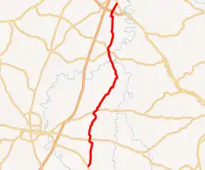
KY 622 highlighted in red | ||||
| Route information | ||||
| Maintained by KYTC | ||||
| Length | 20.020 mi[1][2] (32.219 km) | |||
| Major junctions | ||||
| South end | ||||
| North end | ||||
| Location | ||||
| Counties | Simpson, Warren | |||
| Highway system | ||||
| ||||

Route description

The route begins at a junction with KY 73 about one mile (1.6 km) north of the Tennessee state line. KY 622 intersects KY 100, and then it runs concurrently with KY 585 into Gold City. It enters Warren County before crossing KY 240. It provides access to I-65 and I-165 via KY 9007 at an interchange in Plano before ending at a junction with Scottsville Road (U.S. Route 231, US 231) on the southern outskirts of Bowling Green.[3]
The route is known as Rapids Hickory Flat Road for its course between KY 73 and KY 100.
Kentucky Route 622 is a 20.020-mile-long (32.219 km) state highway that runs from Kentucky Route 73 south of Hickory Flat to TBA via Hickory Flat, Gold City, Temperance,
Major intersections
| County | Location | mi[1][2] | km | Destinations | Notes |
|---|---|---|---|---|---|
| Simpson | | 0.000 | 0.000 | Southern terminus | |
| Hickory Flat | 3.178 | 5.114 | |||
| | 5.860 | 9.431 | Northern terminus of KY 2601 | ||
| | 6.513 | 10.482 | South end of KY 585 overlap | ||
| Gold City | 6.979 | 11.232 | North end of KY 585 overlap | ||
| Warren | | 14.255 | 22.941 | South end of KY 240 overlap | |
| | 14.342 | 23.081 | North end of KY 240 overlap | ||
| | 14.574 | 23.455 | Eastern terminus of KY 242 | ||
| | 18.995 | 30.569 | KY 9007 exit 1 | ||
| Bowling Green | 20.020 | 32.219 | Northern terminus | ||
1.000 mi = 1.609 km; 1.000 km = 0.621 mi
| |||||
References
- Division of Planning (n.d.). "Official Milepoint Route Log Extract (Simpson County)". Highway Information System. Kentucky Transportation Cabinet. Retrieved April 30, 2019.
- Division of Planning (n.d.). "Official Milepoint Route Log Extract (Warren County)". Highway Information System. Kentucky Transportation Cabinet. Retrieved April 30, 2019.
- DeLorme (2010). Kentucky Atlas & Gazetteer (Map) (4th ed.). Yarmouth, ME: DeLorme. p. 81.