Kentucky Route 78
Kentucky Route 78 (KY 78) is a 25.300-mile-long (40.716 km) state highway in Kentucky that runs from KY 49 in rural Casey County northwest of Liberty to U.S. Route 150 (US 150) southeast of Stanford via Hustonville and Stanford.
| ||||
|---|---|---|---|---|
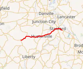
KY 78 highlighted in red | ||||
| Route information | ||||
| Maintained by KYTC | ||||
| Length | 25.300 mi[1] (40.716 km) | |||
| Major junctions | ||||
| West end | ||||
| East end | ||||
| Location | ||||
| Counties | Casey, Lincoln | |||
| Highway system | ||||
| ||||

Major intersections
| County | Location | mi[1] | km | Destinations | Notes |
|---|---|---|---|---|---|
| Casey | | 0.000 | 0.000 | Western terminus | |
| | 4.125 | 6.639 | Southern terminus of KY 243 | ||
| | 9.119 | 14.676 | West end of KY 906 overlap | ||
| | 9.303 | 14.972 | East end of KY 906 overlap | ||
| Lincoln | Hustonville | 12.077 | 19.436 | ||
| | 16.941 | 27.264 | Northern terminus of KY 198 | ||
| | 19.954 | 32.113 | Eastern terminus of KY 1194 | ||
| | 21.331 | 34.329 | West end of KY 300 overlap | ||
| Stanford | 22.161 | 35.665 | Eastern terminus of KY 2319 | ||
| 22.195 | 35.719 | East end of KY 330 overlap | |||
| 22.336 | 35.946 | West end of KY 1247 overlap | |||
| 22.409 | 36.064 | East end of KY 1247 overlap | |||
| 22.987 | 36.994 | ||||
| | 25.300 | 40.716 | Eastern terminus | ||
| 1.000 mi = 1.609 km; 1.000 km = 0.621 mi | |||||
References
- "Official DMI Route Log". Kentucky Transportation Cabinet. Retrieved 27 June 2014.
This article is issued from Wikipedia. The text is licensed under Creative Commons - Attribution - Sharealike. Additional terms may apply for the media files.