Khariar Road
Khariar Road is a town and a Notified Area Council in Nuapada district in the Indian state of Odisha. Khariar Road is connected to Mahasamund - Raipur through National Highway 353 as well as the Indian Railway East Coast Railway
Khariar Road | |
|---|---|
Town | |
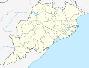 Khariar Road Location in Odisha, India  Khariar Road Khariar Road (India) | |
| Coordinates: 20.899°N 82.509°E | |
| Country | |
| State | Odisha |
| District | Nuapada |
| Population (2011) | |
| • Total | 16,629 |
| Languages | |
| • Official | Odia |
| Time zone | UTC+5:30 (IST) |
| PIN | 766104 |
| Telephone code | 06678 |
| Vehicle registration | OD |
| Website | odisha |
Topography
Khariar Road is situated on a vast plain land with very slight variations in land level. It has one and only river named Jonk which a tributary of Mahanadi. Most of the town gets its water supply from this river. Khariar Road is surrounded by some small mountains. These mountains are the part of the Eastern Ghats. The land here has medium range fertility and most of the farmers here prefer to grow rice. Overall it has a well to do topography. But in the season of summer it faces water scarcity as the river gets dried during that time.
Economic condition
In the last 15–20 years Khariar Road has grown to become one of the most growing economic and business hubs in Nuapada. As it is situated near the border of Chhattisgarh and is also just 10 km (6.2 mi) from Nuapada, it has an easy access and transport facility for trading. Most of the businessmen buy the supplies from Raipur and sell it in the market. Most of the people from Nuapada and nearby villages come here and buy their supplies. After the development of its railway station it has gained more economy.
Demographics
According to the 2011 Census of India[1] Khariar Road had a population of 16,629. Males constituted 51% of the population and females 49%. Khariar Road had an average literacy rate of 61%, higher than the national average of 59.5%; male literacy was 70% and female literacy 51%. In Khariar Road, 14% of the population was under 6 years of age.
Schools
- Delhi Public School
- Navjyoti Vidyalaya
- Gopobandhu High School
- Saraswati Vidyamandir
- Gurukul aashram
- Gurunanak public school
- Gyanjyoti kr vidlaya
- KG Sharaff Public school
- Daddtarya High school