Chhatrapur
Chatrapur (also spelt as Chhatrapur) is a town and a Municipality in Ganjam district in the state of Odisha, India. It is the district headquarters town of Ganjam district. Chhatrapur is a Tehsil / Block (CD) in the Ganjam District of Odisha. According to Census 2011 information the sub-district code of Chhatrapur block is 03085. Total area of Chhatrapur is 124 km2 (48 sq mi) including 119.92 km2 (46.30 sq mi) rural area and 4.40 km2 (1.70 sq mi) urban area. Chhatrapur has a population of 94,683 people. There are 20,415 houses in the sub-district. There are about 46 villages in Chhatrapur block
Chatrapur | |
|---|---|
Town | |
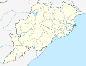 Chatrapur Location in Odisha, India  Chatrapur Chatrapur (India) | |
| Coordinates: 19.35°N 84.98°E | |
| Country | |
| State | |
| District | Ganjam |
| Government | |
| • Type | Municipality |
| • Body | Municipality |
| Area | |
| • Total | 4.4 km2 (1.7 sq mi) |
| Area rank | 2nd |
| Elevation | 17 m (56 ft) |
| Population (2011) | |
| • Total | 22,027 [1] |
| • Rank | 100 |
| Languages | |
| • Official | Odia |
| Time zone | UTC+5:30 (IST) |
| PIN | 761020[2] |
| Telephone code | 06811 |
| Vehicle registration | OD-07 |
| Website | www |
Demographics
As of 2011 India census,[3] Chhatarpur had a population of 20,288 (Second biggest city in the district of Ganjam after Brahmapur. Males constitute 51% of the population and females 49%. Chhatarpur has an average literacy rate of 89%, higher than the national average of 59.5%; with male literacy of 85% and female literacy of 73%. 10% of the population is under 6 years of age.
Transport
Chatrapur is the administrative capital of Ganjam and gateway to south Odisha, and has a well-developed transportation network. All express trains of Indian railway has a halt here. Well connected with the Howrah madras highway so all luxury busses also passing through.
Road
Chatrapur city is connected with National Highways NH-16 (Chennai – Kolkata), NH-59 (Khariar – Brahmapur) and State Highway 36 (Odisha) (Surada to Chatrapur via Hinjilicut) with other cities and towns of Odisha. The three-wheeler auto taxis are the most important mode of transportation in this city. Taxis also ply on the city's roads. The Ganjam Urban Transport Services Limited (GUTSL) with joint partnership with Odisha State Road Transport Corporation (OSRTC) have come up with an agreement, valid for one year, to run a city-bus service for Berhampur to Chatrapur and urban centres on its periphery (Gopalpur, and Hinjli) on 27 February 2014.[5][6]
Rail
Chatrapur railway station is situated on the East coast railway line which is a major route connecting the two metros Kolkata and Chennai of India. It is directly connected to New Delhi, Ahmadabad, Bangalore, Bhubaneswar, Berhampur, Chennai, Cuttack, Mumbai, Nagpur, Pune, Puri, Vishakhapatnam, Hyderabad, Kolkata, Raipur, Sambalpur and many more cities of India. Bhubaneswar – Chatrapur connectivity (DMU) is popular connectivity to reach capital city Bhubaneswar.
There are two railway stations in Chatrapur; they are Chatrapur Station CAP and Chatrapur Court Station which is a Passenger Halt.
History
The Ganjam area was a part of the ancient Kalinga empire which was occupied by King Ashoka in 261 B.C During this period it was the main route of South and East for shipping. Its huge number of black elephants attracted king Ashok for invading Kalinga.
The district was named after the old township and European fort of Ganjam situated on the northern bank of river Rushikulya, which was the headquarter of the district. In 1757 it was French Commander Bussy, who marched into Ganjam and realized areas of tribute from feudal chiefs. It was the English who ultimately defeated the French in the Deccan and annexed Ganjam in 1759.
The modern Ganjam carved out of the Vizag district of Madras Presidency and came into existence on 31.03.1936. Ganjam district separated from Madras Presidency and formed a part of the newly created state of Odisha with effect from 1.4.1936. The re-organized district comprises the whole of Ghumusar, Chatrapur and Baliguda divisions, part of old Berhampur taluk, part of old Ichhapur taluk, part of Parlakhemundi plains and the whole of Parlakhemundi agency area in the old Chicacola division.
In the year 1992, after reorganization of districts by Government of Odisha, the 7 blocks of Parlakhemundi subdivision were separated and the new district of Gajapati formed and 3 subdivisions, 22 blocks, and 18 urban areas remain in Ganjam district.
Tourist places
- Gopalpur-On-Sea
- Tara Tarini – The manifestations of Adi Shakti
- Chilika (Rambha)– A brackish water lagoon
- Panchama – Siddhi Vinayak Temple
- Bhairabi Temple
- Maa Balakumari Hill top near Dhanaghara, Chikitigada
- Parashuram kund, Puriasahi near Tumbagada
- Mahendrgiri hills - Burakhat pass [2nd highest mountains range of Odisha] in Ganjam and Gajapati District Border
- Surangigada Jagannath Mandir
- Baghalati Dam project and Kureisuni temple near Turubudi in patrapur block
- Mankadadian waterfall
- Bhanjanagar Rasullkonda Dam, Children park, Shora devi temple on Ghat route, DahaDam wetland project, Maa Bapangi temple on Ghumusar south division forest
- Kulada Byagradevi, Bellaguntha metal works
- Olive Ridley turtles at Rushikulya river/sea mouth
- Narayani devi Temple near Valleri hill
- Nirmalajhar, Khallikote Jagannath temple, Charukala Art College
- TAPTAPANI – A Hot Water Spring
- Ghodahada Dam Project - Kamarigaon Shiva temple hillside Lake
- Buddhakhol – Panchu Mahadeva Temple
- Biranchi Narayana temple at Buguda - Dhanei Dam Project - Bachha Dam project, Maa Sankulei Hill top temple
- Mahurikalua – Shakti Peetha
- Tampara Lake - Water Lagoon with Boating Facilities
- Potagada - Portuguese's wreckage fort at Rushikulyaya river mouth near Ganjam town
- Arjyapalli - Marine Beach
- Ramachandi Hill top Temple near Podapadar, Chhatarpur town
- Narayanapur - Backwater at Gopalpur
Climate and regional setting
Maximum summer temperature is 37 °C; minimum winter temperature is 16 °C. The mean daily temperature varies from 33 °C to 38 °C. May is the hottest month; December is the coldest. The average annual rainfall is 1250 mm and the region receives monsoon and torrential rainfall from July to October.
| Climate data for Chhatrapur, Odisha | |||||||||||||
|---|---|---|---|---|---|---|---|---|---|---|---|---|---|
| Month | Jan | Feb | Mar | Apr | May | Jun | Jul | Aug | Sep | Oct | Nov | Dec | Year |
| Average high °C (°F) | 27 (81) |
30 (86) |
34 (93) |
36 (97) |
37 (99) |
34 (93) |
32 (90) |
31 (88) |
32 (90) |
32 (90) |
30 (86) |
28 (82) |
32 (90) |
| Average low °C (°F) | 16 (61) |
19 (66) |
23 (73) |
27 (81) |
29 (84) |
28 (82) |
27 (81) |
27 (81) |
26 (79) |
23 (73) |
20 (68) |
16 (61) |
23 (74) |
| Average rainfall cm (inches) | 1.2 (0.5) |
1.70 (0.67) |
1.90 (0.75) |
1.50 (0.59) |
4.00 (1.57) |
15.00 (5.91) |
28.20 (11.10) |
27.30 (10.75) |
18.00 (7.09) |
9.30 (3.66) |
3.30 (1.30) |
1.90 (0.75) |
113.3 (44.64) |
| Source: MSM Weather | |||||||||||||
Politics
In 2019 MLA from Chatrapur Assembly Constituency is Subash Chandra Behera of BJD, who won the seat in State elections of 2019. Previous MLAs from this seat include Dr Priyanshu Pradhan of BJD who won this seat in 2014, Narayan Reddy of CPI who won this seat in 2004 Rama Chandra Panda of BJP who won this seat in 2000, Daitari Behera of INC in 1995, Parsuram Panda of CPI in 1990, Ashok Kumar Choudhury of INC in 1985, and Biswanath Sahu of CPI in 1980 and in 1977.[7]
in 2014
In this year five political party filled Nomination in election of MLA in Chhatrapur (Odisha Vidhan Sabha constitution).[8]
- BJD-PRIYANSU PRADHAN. (Won MLA in Chatrapur)
- BJP-DHARANI DHARA BEHERA
- CONG- BONAMALI SETHY
- CPI-KRUSNA CHANDRA NAYAK
- AAP-mis SETHY
MP filled nomination for Chatrapur
- CONG-CHANDRASAKHER SAHU
- BJD-SIDHANT MAHAPATRA (Won MP seat in Chatrapur)
- BJP-RAMA PANDA
- CPI M-ALI PATNAYAK
- APP- JANASWER MISHRA
- SWADHINA- SYAMBABU SUBUDHI
Chatrapur is part of Berhampur (Lok Sabha constituency).[9]
References
- "Urban Agglomerations/Cities having Census 2011-2020 in Orissa". Registrar General and Census Commissioner of India. Retrieved 10 October 2014.
- "PinCode: CHATRAPUR, GANJAM, ORISSA, India, Pincode.net.in". pincode.net.in. 2012. Retrieved 1 July 2012.
PinCode: 761020
- "Census of India 2001: Data from the 2001 Census, including cities, villages and towns (Provisional)". Census Commission of India. Archived from the original on 16 June 2004. Retrieved 1 November 2008.
- "Urban Agglomerations/Cities having Census 2011-2020 in Orissa". Registrar General and Census Commissioner of India. Retrieved 10 October 2014.
- Staff Reporter (27 February 2014). "Naveen inaugurates bus service". The Hindu. Retrieved 3 June 2018.
- Staff Reporter. "City bus service to Berhampur, urban centres soon". The Hindu.
- "State Elections 2004 - Partywise Comparison for 72-Chatrapur Constituency of Odisha". Election Commission of India. Retrieved 25 September 2008.
- "Assembly Constituencies - Corresponding Districts and Parliamentary Constituencies of Odisha" (PDF). Election Commission of India. Archived from the original (PDF) on 4 March 2009. Retrieved 25 September 2008.
- "Assembly Constituencies - Corresponding Districts and Parliamentary Constituencies of Odisha" (PDF). Election Commission of India. Archived from the original (PDF) on 4 March 2009. Retrieved 25 September 2008.