Khlong Lan District
Khlong Lan (Thai: คลองลาน, pronounced [kʰlɔ̄ːŋ lāːn]) is the westernmost district (amphoe) of Kamphaeng Phet Province, central Thailand.
Khlong Lan
คลองลาน | |
|---|---|
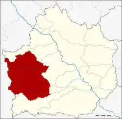 District location in Kamphaeng Phet Province | |
| Coordinates: 16°12′13″N 99°19′16″E | |
| Country | Thailand |
| Province | Kamphaeng Phet |
| Seat | Khlong Nam Lai |
| Area | |
| • Total | 1,140.2 km2 (440.2 sq mi) |
| Population (2005) | |
| • Total | 63,106 |
| • Density | 55.3/km2 (143/sq mi) |
| Time zone | UTC+7 (ICT) |
| Postal code | 62180 |
| Geocode | 6203 |
History
The area was originally part of Mueang Kamphaeng Phet District, then named Tambon Pong Nam Ron. The tambon Khlong Lan and Pong Nam Ron were upgraded to a minor district (king amphoe) on 1 June 1977.[1] It was officially upgraded to a full district on 20 March 1986.[2]
Geography
Neighboring districts are (from the east clockwise): Mueang Kamphaeng Phet, Khlong Khlung, Pang Sila Thong of Kamphaeng Phet Province; Umphang, Phop Phra and Wang Chao of Tak Province.
Administration
The district is divided into four subdistricts (tambons), which are further subdivided into 69 villages (mubans). There are no municipal (thesaban) areas. There are four tambon administrative organizations (TAO).
| No. | Name | Thai name | Villages | Pop. | |
|---|---|---|---|---|---|
| 1. | Khlong Nam Lai | คลองน้ำไหล | 28 | 19,634 | |
| 2. | Pong Nam Ron | โป่งน้ำร้อน | 10 | 9,119 | |
| 3. | Khlong Lan Phatthana | คลองลานพัฒนา | 21 | 23,699 | |
| 4. | Sak Ngam | สักงาม | 10 | 10,654 |
References
- ประกาศกระทรวงมหาดไทย เรื่อง แบ่งท้องที่อำเภอเมืองกำแพงเพชร จังหวัดกำแพงเพชร ตั้งเป็นกิ่งอำเภอคลองลาน (PDF). Royal Gazette (in Thai). 94 (46 ง): 2234. May 31, 1977.
- พระราชกฤษฎีกาตั้งอำเภอคลองลาน อำเภอสุคิริน อำเภอตะโหมด อำเภอห้วยทับทัน และอำเภอปากคาด พ.ศ. ๒๕๒๙ (PDF). Royal Gazette (in Thai). 103 (45 ก special): 4–7. March 20, 1986.