Kamphaeng Phet Province
Kamphaeng Phet (Thai: กำแพงเพชร, pronounced [kām.pʰɛ̄ːŋ pʰét]) is one of thailand's seventy-six provinces (changwat) lies in lower northern Thailand. Neighbouring provinces are (from north clockwise) Sukhothai, Phitsanulok, Phichit, Nakhon Sawan, and Tak.
Kamphaeng Phet
กำแพงเพชร | |
|---|---|
 Khlong Lan Waterfall, Khlong Lan National Park, Khlong Lan District | |
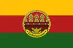
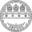
 Flag  Seal | |
| Nickname(s): Chakungrao Mueang Kluai Khai (city of lady finger bananas) | |
| Motto(s): "กรุพระเครื่อง เมืองคนแกร่ง พระแสงฯ ล้ำค่า ศิลาแลงใหญ่ กล้วยไข่หวาน น้ำมันลานกระบือ เลื่องลือมรดกโลก" ("Buddha amulet chamber, Strong city, Phra Saeng precious,
Laterite, Banana Egg, Lan Krabue oil and Famed world heritage") | |
 Map highlighting Kamphaeng Phet Province | |
| Country | Thailand |
| Government | |
| • Governor | Thani Thanyaphot (since 2015) |
| Area | |
| • Total | 8,607 km2 (3,323 sq mi) |
| Area rank | Ranked 22nd |
| Population (2018)[2] | |
| • Total | 727,807 |
| • Rank | Ranked 34th |
| • Density | 85/km2 (220/sq mi) |
| • Density rank | Ranked 58th |
| Human Achievement Index | |
| • HAI (2017) | 0.5643 "somewhat low" Ranked 60th |
| Time zone | UTC+7 (ICT) |
| Postal code | 62xxx |
| Calling code | 055 |
| ISO 3166 code | TH-62 |
| Vehicle registration | กำแพงเพชร |
| Website | www |
Toponymy
In Thai or Lao kamphaeng means 'wall' and phet (from Sanskrit vájra) means 'diamond'. The name means 'wall as hard as diamond'. This wall served as a defensive line to protect the Ayutthaya Kingdom from what is now modern-day Burma. The old name was Khao Kampeng, referring to a 'mountain wall' between the two countries.
Geography
The main river is the Ping, a major tributary of the Chao Phraya River. River flats make up much of the east of the province, while the west is mountainous and covered with forests.
One of the provinces best-known products is bananas, especially the kluai khai, a small, round, sweet banana. Banana festivals are held every year to thank the spirits for the harvest.
History
Kamphaeng Phet was already a royal city in the Sukhothai Kingdom in the 14th century, then known under its old name Chakangrao. It formed an important part of the defence system of the kingdom, as well as later of the Ayutthaya Kingdom.
Symbols
The provincial seal shows the city walls surmounted by diamonds, since the city name means 'diamond wall' (from the shape of the ramparts of the old city wall). The provincial tree is the areca nut palm (Acacia catechu), and the provincial flower the bullet wood (Mimusops elengi). Golden belly barb (Hypsibarbus wetmorei) is provincial fish, since it is a fish found in the Ping river especially in the area of Kamphaeng Phet.[4]
Administrative divisions

provincial government
The province is divided into 11 districts (amphoes). These are further divided into 78 subdistricts (tambons) and 823 villages (mubans).
Local government
As of 26 November 2019 there are:[5] one Kamphaeng Phet Provincial Administration Organisation (ongkan borihan suan changwat) and 25 municipal (thesaban) areas in the province. Kamphaeng Phet, Pang Makha and Nong Pling have town (thesaban mueang) status. Further 22 subdistrict municipalities (thesaban tambon). The non-municipal areas are administered by 64 Subdistrict Administrative Organisations - SAO (ongkan borihan suan tambon).[2]
Human achievement index 2017
| Health | Education | Employment | Income |
| 54 | 67 | 70 | 12 |
| Housing | Family | Transport | Participation |
 |
 |
 |
|
| 36 | 60 | 51 | 15 |
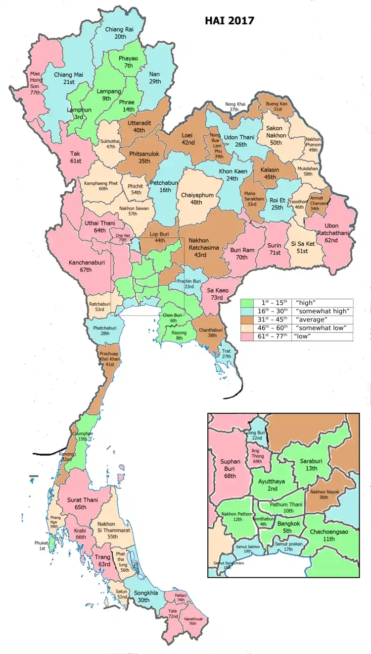
| Province Kamphaeng Phet, with an HAI 2017 value of 0.5643 is "somewhat low", occupies place 60 in the ranking. | |||
Since 2003, United Nations Development Programme (UNDP) in Thailand has tracked progress on human development at sub-national level using the Human achievement index (HAI), a composite index covering all the eight key areas of human development. National Economic and Social Development Board (NESDB) has taken over this task since 2017.[3]
| Rank | Classification |
| 1 - 15 | "high" |
| 16 - 30 | "somewhat high" |
| 31 - 45 | "average" |
| 45 - 60 | "somewhat low" |
| 61 - 77 | "low" |
| Map with provinces and HAI 2017 rankings |
 |
Notable residents
- Saman Sorjaturong: WBC & IBF light flyweight world champion
- Kaeo Pongprayoon: 2012 Summer Olympics silver medalist
Gallery
 Banana Festival
Notes
Reports (data) from Thai government are "not copyrightable" (Public Domain), Copyright Act 2537 (1994), section 7.
References
- Advancing Human Development through the ASEAN Community, Thailand Human Development Report 2014, table 0:Basic Data (PDF) (Report). United Nations Development Programme (UNDP) Thailand. pp. 134–135. ISBN 978-974-680-368-7. Retrieved 17 January 2016, Data has been supplied by Land Development Department, Ministry of Agriculture and Cooperatives, at Wayback Machine.
- "รายงานสถิติจำนวนประชากรและบ้านประจำปี พ.ศ.2561" [Statistics, population and house statistics for the year 2018]. Registration Office Department of the Interior, Ministry of the Interior (in Thai). 31 December 2018. Retrieved 20 June 2019.
- Human achievement index 2017 by National Economic and Social Development Board (NESDB), pages 1-40, maps 1-9, retrieved 14 September 2019, ISBN 978-974-9769-33-1
- Cheevasitthiyanon, Supa (2018-08-20). "จังหวัดกำแพงเพชร ประกาศให้ "ปลาตะพาก" เป็นปลาประจำจังหวัด" [Kamphaeng Phet province declares "golden belly barb" as the provincial fish]. PRD (in Thai). Retrieved 2020-04-22.
- "Number of local government organizations by province". dla.go.th. Department of Local Administration (DLA). 26 November 2019. Retrieved 10 December 2019.
4 Kamphaeng Phet: 1 PAO, 3 Town mun., 22 Subdistrict mun., 64 SAO.
External links
 Kamphaeng Phet travel guide from Wikivoyage
- Provincial page from the Tourist Authority of Thailand
- Website of Province (Thai)