Kokopo
Kokopo is the capital of East New Britain in Papua New Guinea. It is administered under Kokopo-Vunamami Urban LLG.
Kokopo | |
|---|---|
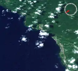
 Satellite image | |
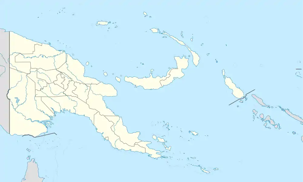
 Kokopo Location within New Britain and Ireland | |
| Coordinates: 4°21′00″S 152°16′25″E | |
| Country | Papua New Guinea |
| Province | East New Britain |
| District | Kokopo District |
| LLG | Kokopo-Vunamami Urban |
| Elevation | 4 m (13 ft) |
| Population (2000) | |
| • Total | 20,262 |
| • Rank | 8th |
| Languages | |
| • Main languages | Kuanua, Tok Pisin, English |
| Time zone | UTC+10 (AEST) |
| Location | 20 km (12 mi) from Rabaul |
| Mean max temp | 31.0 °C (87.8 °F) |
| Mean min temp | 23.3 °C (73.9 °F) |
| Annual rainfall | 2,003 mm (78.86 in) |
| Climate | Af |
The capital was moved from Rabaul in 1994 when the volcanoes Tavurvur and Vulcan erupted. As a result, the population of the town increased more than sixfold from 3,150 in 1990 to 20,262 in 2000.[1]
Kokopo was known as Herbertshöhe (Herbert's Heights) during the German New Guinea administration which controlled the area between 1884 and formally until 1919. Until 1910 it was the capital of German New Guinea.
On Sunday, March 29, 2015, a strong earthquake, of a preliminary magnitude of at least 7.5, which at that time was the largest earthquake of 2015, was recorded near Kokopo, and a tsunami warning was issued. This was surpassed a month later by the April 2015 Nepal earthquake, which measured a magnitude 7.8.
A research and conservation project has been suggested to study and protect spinner dolphins[2] living around Kokopo beach, as this population may be threatened if construction of a new port for larger shipping lanes is initiated.[3]
Communication links
The remains of the former capital Rabaul are located some 20 km (12 mi) to the north-east of Kokopo, when using the Kokopo-Rabaul Highway. There are around 4,000 inhabitants in Rabaul, down from over 17,000 before the latest volcanic eruption.
Rabaul Airport (also called "Tokua Airport"), one of Papua New Guinea's largest domestic airports, is located a few kilometres east of Kokopo.
Climate
Kokopo has a tropical rainforest climate (Af) with heavy rainfall year-round.
| Climate data for Kokopo | |||||||||||||
|---|---|---|---|---|---|---|---|---|---|---|---|---|---|
| Month | Jan | Feb | Mar | Apr | May | Jun | Jul | Aug | Sep | Oct | Nov | Dec | Year |
| Average high °C (°F) | 30.7 (87.3) |
30.8 (87.4) |
30.6 (87.1) |
30.6 (87.1) |
30.8 (87.4) |
30.6 (87.1) |
29.9 (85.8) |
30.1 (86.2) |
31.0 (87.8) |
31.2 (88.2) |
31.3 (88.3) |
30.8 (87.4) |
30.7 (87.3) |
| Daily mean °C (°F) | 27.0 (80.6) |
27.0 (80.6) |
27.0 (80.6) |
26.9 (80.4) |
27.2 (81.0) |
27.0 (80.6) |
26.5 (79.7) |
26.5 (79.7) |
27.1 (80.8) |
27.2 (81.0) |
27.4 (81.3) |
27.1 (80.8) |
27.0 (80.6) |
| Average low °C (°F) | 23.4 (74.1) |
23.3 (73.9) |
23.5 (74.3) |
23.3 (73.9) |
23.6 (74.5) |
23.4 (74.1) |
23.1 (73.6) |
23.0 (73.4) |
23.3 (73.9) |
23.3 (73.9) |
23.5 (74.3) |
23.4 (74.1) |
23.3 (74.0) |
| Average precipitation mm (inches) | 185 (7.3) |
188 (7.4) |
209 (8.2) |
191 (7.5) |
124 (4.9) |
139 (5.5) |
167 (6.6) |
154 (6.1) |
130 (5.1) |
127 (5.0) |
156 (6.1) |
217 (8.5) |
1,987 (78.2) |
| Source: [4] | |||||||||||||
PNG Hunters
The Papua New Guinea Hunters (PNG Hunters) are a rugby league football club based in Kokopo. They were established in 2013 and currently compete in the QRL's Intrust Super Cup.[5] The Hunters' home ground is Kalabond Oval in Kokopo and their team colours are red, black and gold.[6]
References
- PNG Census 2000
- 2016. Papua New Guinea 2016 Trip Report (pdf). Retrieved on March 31, 2017
- Ochi T.. 2015. ハシナガイルカの生息地を守るプロジェクト ~戦後70年。パプアニューギニア・ラバウルの海を潜る~. ダイビングと海の総合サイト・オーシャナ (Ocean α). Retrieved on March 31, 2017
- https://en.climate-data.org/location/50976
- "Papua New Guinea gain entry to Queensland Cup 2014". ABC News. 28 November 2013.
- Pangkatana, John (24 December 2013). "Q-Cup name unveiled". The National.