Kolno County
Kolno County (Polish: powiat kolneński) is a unit of territorial administration and local government (powiat) in Podlaskie Voivodeship, north-eastern Poland. It came into being on January 1, 1999, as a result of the Polish local government reforms passed in 1998. Its administrative seat and largest town is Kolno, which lies 89 kilometres (55 mi) west of the regional capital Białystok. The only other town in the county is Stawiski, lying 16 km (10 mi) east of Kolno.
Kolno County
Powiat kolneński | |
|---|---|
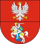
 Flag  Coat of arms | |
 | |
| Coordinates (Kolno): 53°24′38″N 21°56′2″E | |
| Country | |
| Voivodeship | Podlaskie |
| Seat | Kolno |
| Gminas | Total 6 (incl. 1 urban)
|
| Area | |
| • Total | 939.73 km2 (362.83 sq mi) |
| Population (2019) | |
| • Total | 38,249 |
| • Density | 41/km2 (110/sq mi) |
| • Urban | 12,388 |
| • Rural | 25,861 |
| Car plates | BKL |
| Website | http://www.powiatkolno.home.pl |
The county covers an area of 939.73 square kilometres (362.8 sq mi). As of 2019 its total population is 38,249, out of which the population of Kolno is 10,214, that of Stawiski is 2,174, and the rural population is 25,861.[1]
Neighbouring counties
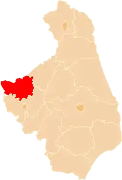
Kolno County is bordered by Pisz County to the north, Grajewo County to the north-east, Łomża County to the south and Ostrołęka County to the west.
Administrative division
The county is subdivided into six gminas (one urban, one urban-rural and four rural). These are listed in the following table, in descending order of population.
| Gmina | Type | Area (km²) |
Population (2019) |
Seat |
| Kolno | urban | 25.1 | 10,214 | |
| Gmina Kolno | rural | 282.1 | 8,601 | Kolno * |
| Gmina Stawiski | urban-rural | 165.6 | 6,105 | Stawiski |
| Gmina Turośl | rural | 198.4 | 5,113 | Turośl |
| Gmina Mały Płock | rural | 140.1 | 4,759 | Mały Płock |
| Gmina Grabowo | rural | 128.5 | 3,457 | Grabowo |
| * seat not part of the gmina | ||||
References
- GUS. "Population. Size and structure and vital statistics in Poland by territorial divison in 2019. As of 30th June". stat.gov.pl. Retrieved 2020-09-14.
External links
The Digital Archive of Kolno Land www.kolnoteka.pl (CAZK)
Seat: Kolno (urban gmina) | ||
| Urban-rural gmina | | |
| Rural gminas | ||